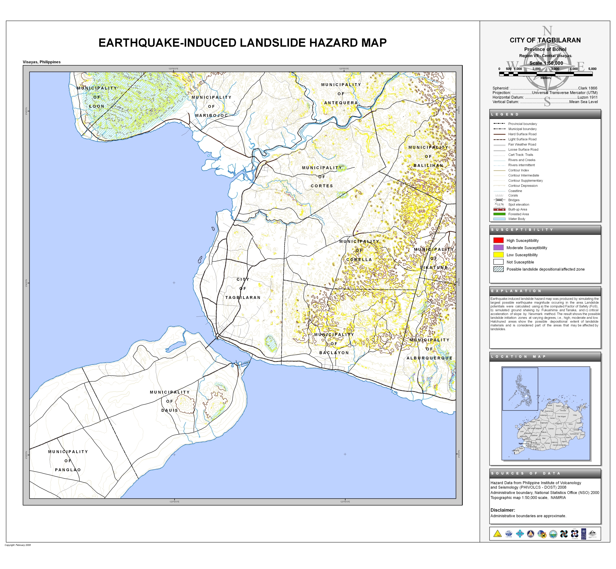
The Earthquake-Induced Landslide Hazard Map of the City of Tagbilaran also cover the municipalities of:
- Cortes
- Corella
- Dauis
Also covered partially in this map are the municipalities of:
- Alburquerque
- Antequera
- Balilihan
- Loon
- Maribojoc
- Panglao
- Sikatuna


Hello my name is Margarida and I’m an architecture studen currently doing my master final work!! I’m doing my thesis about architecture for disasters and since I’m doing my work about the Philipeenes will talk also about Bohol earthquake!! I would like to know if you could arrange me your earthquake- induced landslide hazard maps of Tagbilaran, Maribojoc and Antequera since the ones you have in the site aren’t disponible!!
thank you in advance
best regards
Maria Margarida Infante
I’m not sure what you mean, but if you just want to download the map, you can right-click on the map and select “Save image as…” or anything to that effect depending on your browser.
Dear PPDO Bohol,
Good day! I am currently a grade 10 student of Manga National High School. As part of our performance task regarding the making of a Community-Based Disaster Risk Reduction (CBDRRM) Plan, Hazard Maps of the district (where we reside) are of use. I would like to humbly inquire if the Hazard Map of Barangay Ubujan is available and accessible. Thank you so much!
Sincerely,
Ruth Madaje
Hi Ruth, we only have Hazard Maps of the entire City of Tagbilaran, but barangay boundaries are indicated. We can provide you with soft copies of the maps. Please bring a USB drive to the PPDO Office, 2nd Floor of the New Capitol, look for Willy Bueno.
Dear PPDO Bohol,
Good evening! I am currently a grade 12 student of Colegio de la Inmaculada Concepcion-Cebu. As part of my performance task, I would like to ask for the map of the city of Tagbilaran for earthquake-induced landslides. I cannot view the pictures on the upper part. Thank you so much!
Sincerely,
Andrea Sarmiento