
Download in PDF or in JPG formats
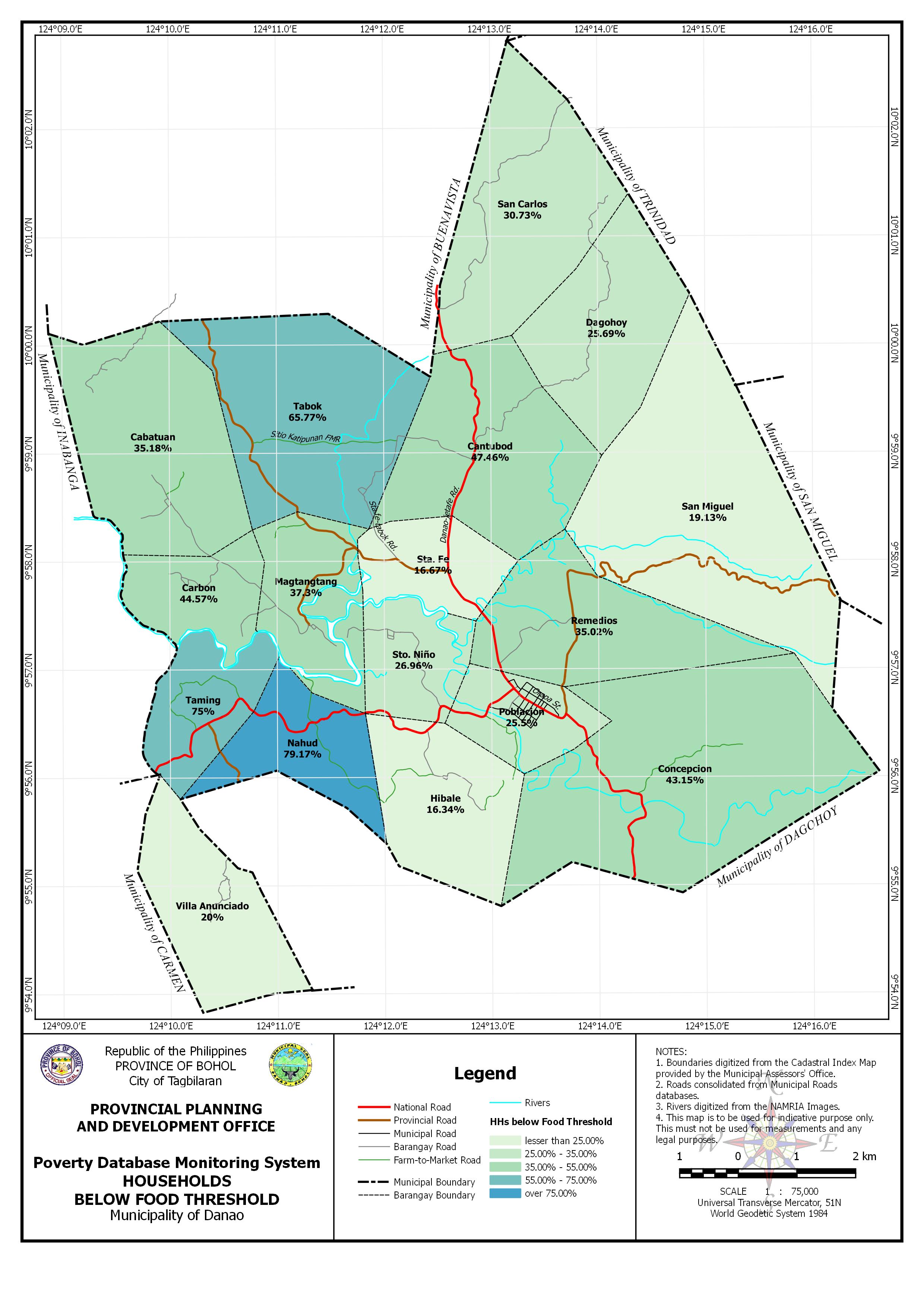
The PDMS – Food Threshold Map of the Municipality of Danao shows the percentage of households below the food threshold per barangay in color gradient based on the Poverty Database and Monitoring System (PDMS). These data was gathered through a household-based survey in 2010.
Available in JPG and PDF, this map may be downloaded and used for free provided that no alterations made to the map and that proper citations be referred to this source.