
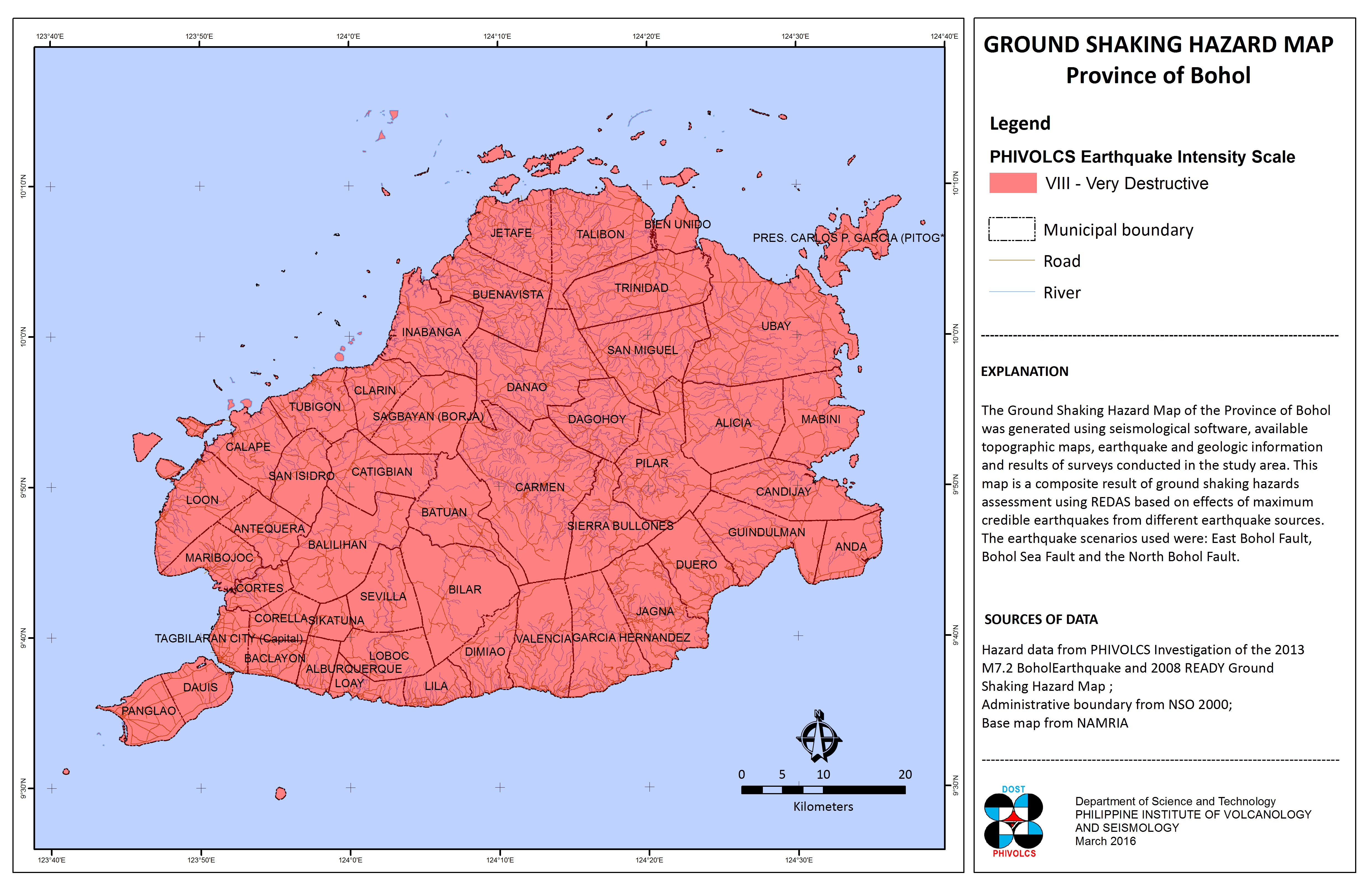
GROUND SHAKING HAZARD MAP, 2016 update
Download in JPG or in PDF formats
GROUND SHAKING HAZARD MAP, 2008

Download in JPG or in PDF formats
The Ground Shaking Hazard shows areas categorized in potential intensities of ground shaking during an earthquake. The Philippine Institute of Volcanology and Seismology (PhIVolcS) categorizes this into: Lower than Intensity VI, Intensity VI, Intensity VII, and, Intensity VIII and above. The scale unit is in PhIVolcS Earthquake Intensity Scale (PEIS), a measure of how an earthquake felt in a certain locality or area. It is based on relative effect to people, structures, and objects in the surroundings. it is represented by Roman Numerals, with Intensity I being the weakest and Intensity X the strongest. It is used since 1996, replacing the Rossie-Forel Scale.
Ground shaking hazard data is from PhIVolcS 2008, Administrative boundary is from National Statistics Office (NSO) 2000, and, Topographic map 2:50,000 scale is from national Mapping and Resource Information Authority (NAMRIA). The Ground Shaking Hazard map was acquired from the Hazards Mapping and assessment for Effective Community-Based Disaster Risk Management (READY) Project through PhIVolcS.
Available in JPG and PDF, this map may be downloaded and used for free provided that: a.) no alterations are made to the map; b.) proper citations be referred to the sources mentioned above; and, c.) all logos appearing on the map should also appear on your document.