Download in PDF or in JPG formats
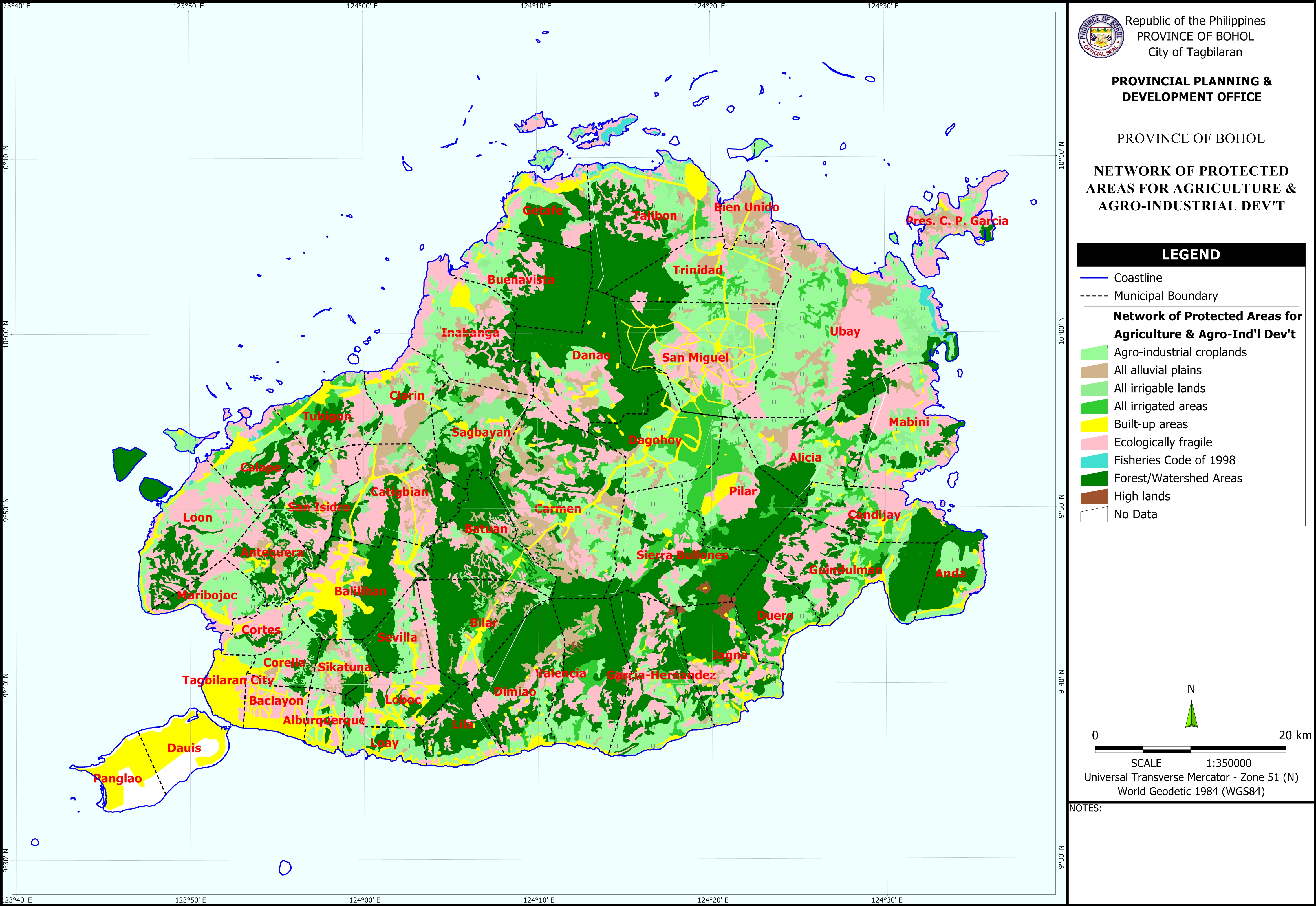
The Network of Protected Areas for Agriculture and Agro-Industrial Development Map shows various areas categorized as follows: Agro-Industrial Croplands, All Alluvial Plains, All Irrigable Lands, All Irrigated Areas, Built-up Areas, Ecologically Fragile, Fishery Code of 1998, Forest/Watershed Areas, and Highlands. Base map features were digitized from the National Mapping and Resource Information Authority (NAMRIA) Topographic Map sheets scaled at 1:50,000 using heads-up digitizing method. The Network of Protected Areas for Agriculture and Agro-Industrial Development (NPAAAD) were digitized from the Bureau of Soils and Water Management (BSWM) NPAAAD map sheets scaled at 1:50,000.
Available in PDF and JPG formats, this map may be downloaded and used for free provided that no alterations are made to the map and that proper citations be referred to this source.


Hi! May I know if we have a blow-up mapping of Ipil River watershed? I would like to use if to my on-going research for potential ecotourism development of Ipil River.
Please check email. Thank you.