Download in PDF or in JPG format
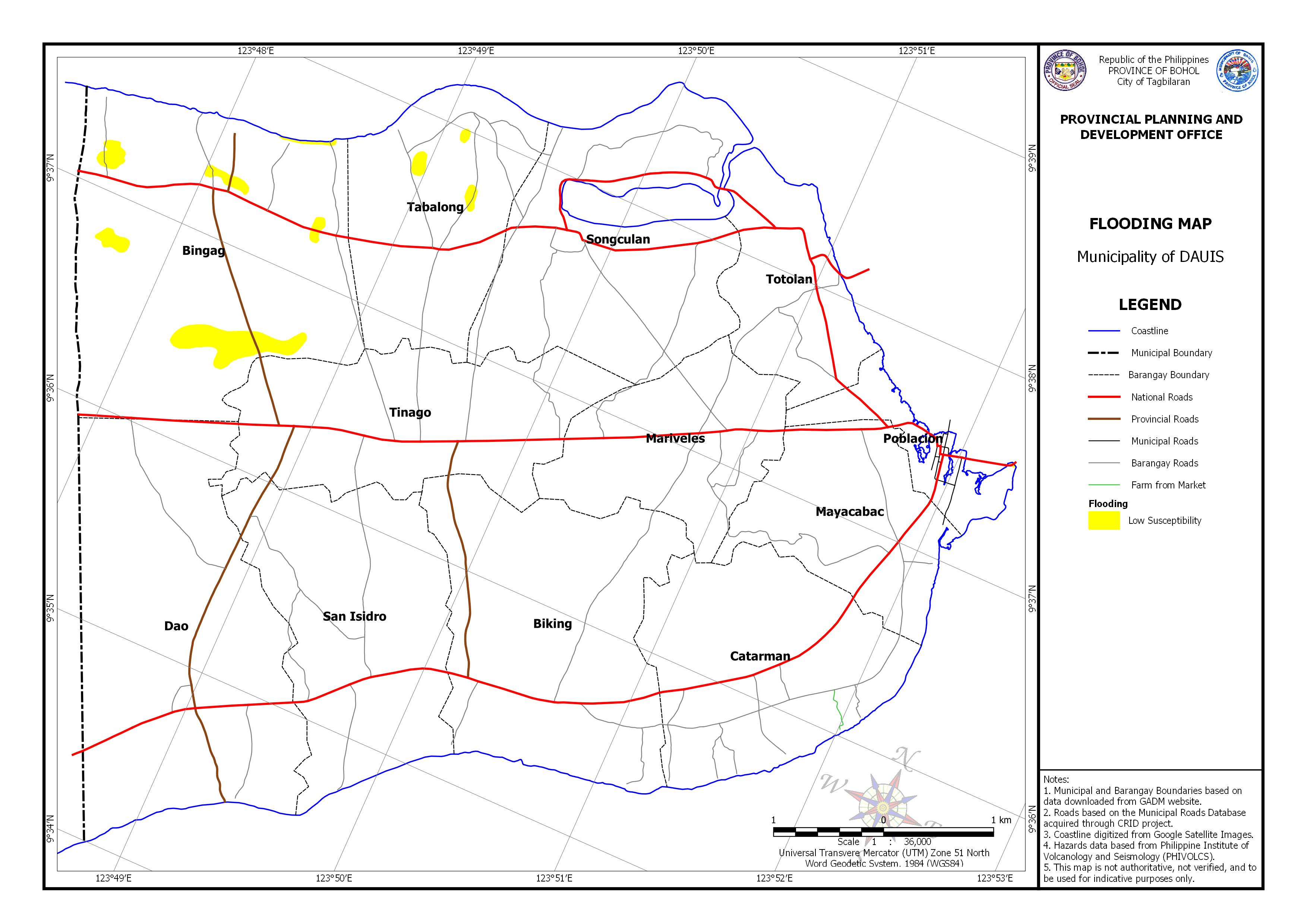
| Barangay | Area | Area Exposed to Low Susceptibility | |
| (Hectares) | (Hectares) | Percentage | |
| Bingag | 637.543 | 37.802 | 5.93% |
| Poblacion | 88.749 | 0.099 | 0.11% |
| Tabalong | 319.378 | 4.78 | 1.50% |
| Total | 4454.22 | 42.68 | 7.54% |

Provincial Planning and Development Office