
Download in PDF and JPG format
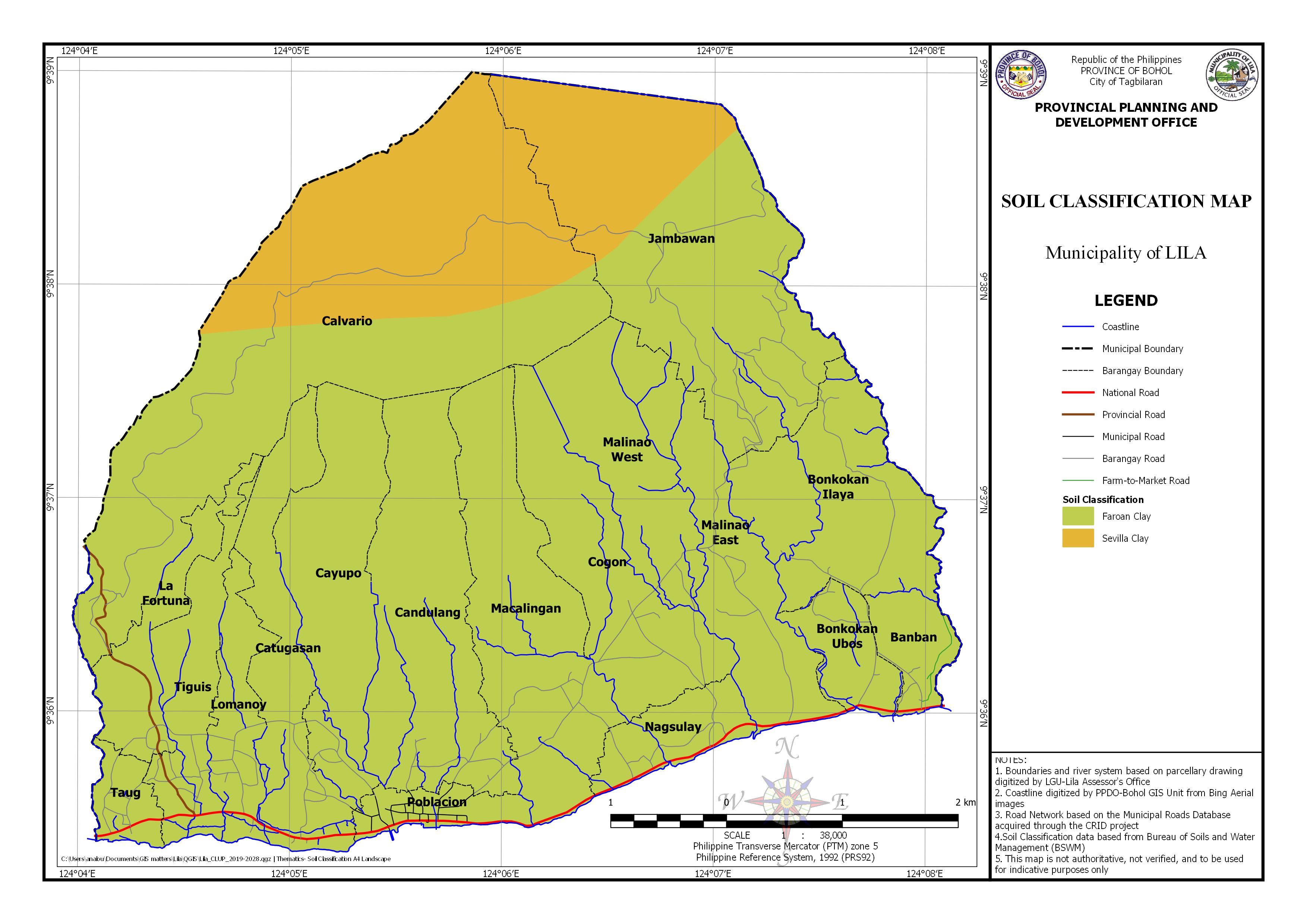
AREA EXPOSED TO SOIL CLASSIFICATION BY BARANGAY
| Barangay | Area | Faraon Clay | Sevilla Clay | ||
|---|---|---|---|---|---|
| (Hectares) | (Hectares) | Percentage | (Hectares) | Percentage | |
| Banban | 54.651 | 54.651 | 100.000% | ||
| Bonkokan Ilaya | 235.481 | 235.481 | 100.000% | ||
| Bonkokan Ubos | 66.327 | 66.327 | 100.000% | ||
| Calvario | 806.148 | 409.249 | 50.766% | 396.89953422894 | 49.234% |
| Candulang | 293.490 | 293.490 | 100.000% | ||
| Catugasan | 171.121 | 171.121 | 100.000% | ||
| Cayupo | 217.302 | 217.302 | 100.000% | ||
| Cogon | 207.025 | 207.025 | 100.000% | ||
| Jambawan | 499.561 | 314.953 | 63.046% | 184.608797794579 | 36.954% |
| La Fortuna | 90.095 | 90.095 | 100.000% | ||
| Lomanoy | 85.477 | 85.477 | 100.000% | ||
| Macalingan | 283.497 | 283.497 | 100.000% | ||
| Malinao East | 194.783 | 194.783 | 100.000% | ||
| Malinao West | 150.937 | 150.937 | 100.000% | ||
| Nagsulay | 70.907 | 70.907 | 100.000% | ||
| Poblacion | 47.646 | 47.646 | 100.000% | ||
| Taug | 39.564 | 39.564 | 100.000% | ||
| Tiguis | 119.020 | 119.020 | 100.000% | ||
| Total | 3633.033 | 3051.525 | 1613.812% | 581.508332023519 | 86.188% |