Download in JPG format
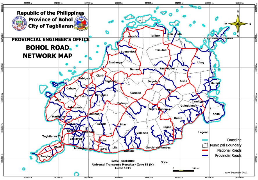
The Road Network Map shows the road network including the national and provincial roads in the province of Bohol with reference to the province’s location in Region VII (Central Visayas) and in the Philippines. The features included in this map were digitized from the National Mapping and Resource Information Authority (NAMRIA) Topographic Map sheets scaled at 1:310,000, specifically the municipal boundaries, using heads-up digitizing method. Also includes the Global Positioning System (GPS) file of the provincial and national roads surveyed by Provincial Engineering Office (PEO) employees. Updated yearly. Available in PDF and JPG formats at the PEO.
Contact Engr. Richard Bompat Jr.
IT Section Head, PEO
New Capitol, Tagbilaran City, Bohol 6300
Telephone (+38) 411-2092, 411-2093 or 235-3925

