Download in JPG format
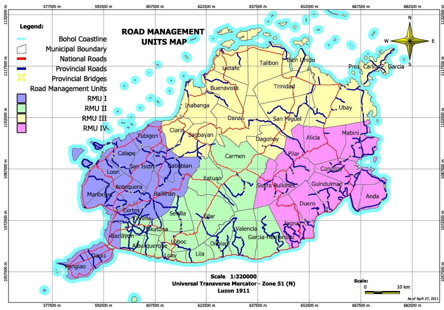
The Road Management Unit (RMU) Maps show the road network within municipalities clustered into four units for road management. The maps indicate the classification of roads. The features included in this map were digitized from the National Mapping and Resource Information Authority (NAMRIA) Topographic Map sheets scaled at 1:190,000 using heads-up digitizing method. Also includes the Global Positioning System (GPS) file of the provincial and national roads surveyed by Provincial Engineering Office (PEO) employees. Available in PDF and JPG formats at the PEO.
Contact Engr. Richard Bompat Jr.
IT Section Head, PEO
New Capitol, Tagbilaran City, Bohol 6300
Telephone +63 (38) 411-2092, 411-2093 or 235-3925


Does the town has something to do with money in a national road highway projects passing thru the town?
I m curious why mayors and barangay are taking credits.
What is the role of mayors about national highway road?
Hi Daniel, we’re not aware of any mayor nor barangay taking credits on national highway road.
Hello Sir Willy. Can I ask for the total length of Sikatuna-Balilihan via Can-agong Provincial Road?
Hi Engr. Racines, according to the data I’m getting, it’s 1.971. I’m not sure of the unit but I presume it’s in km. However, you might want to verify this with the PEO. Thank you.