
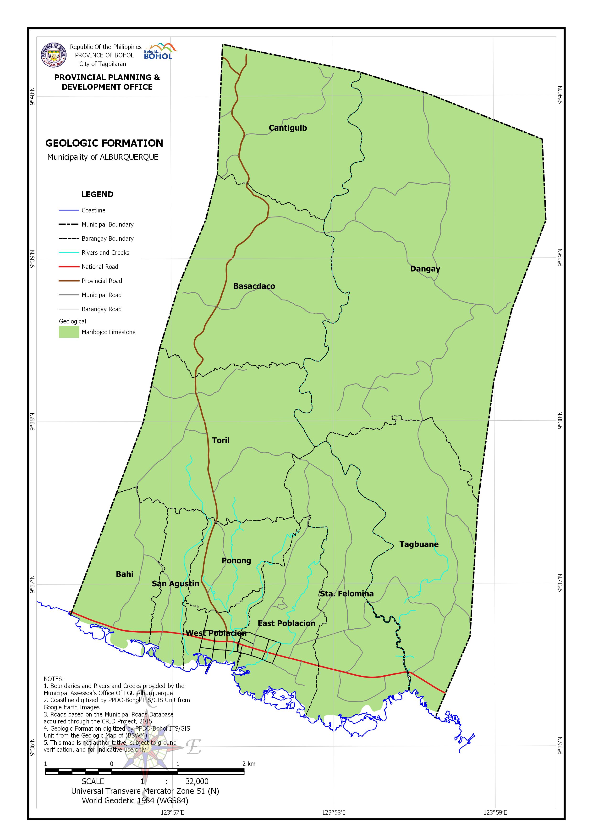
Download in PDF and JPG format
| Barangay | Area | Maribojoc Limestone | No Data | ||
| (Hectares) | (Hectares) | (Percentage) | (Hectares) | (Percentage) | |
| Bahi | 131.978 | 124.868 | 94.61% | 7.109 | 5.39% |
| Basacdaco | 320.521 | 320.521 | 100.00% | ||
| Cantiguib | 244.97 | 244.97 | 100.00% | ||
| Dangay | 815.135 | 815.135 | 100.00% | ||
| East Poblacion | 141.696 | 136.69 | 96.47% | 5.006 | 3.53% |
| Ponong | 89.032 | 89.032 | 100.00% | ||
| San Agustin | 65.521 | 64.656 | 98.68% | 0.865 | 1.32% |
| Sta. Felomina | 242.704 | 230.094 | 94.80% | 12.61 | 5.20% |
| Tagbuane | 319.398 | 318.393 | 99.69% | 1.005 | 0.32% |
| Toril | 308.17 | 308.17 | 100.00% | ||
| West Poblacion | 47.003 | 44.811 | 95.34% | 2.192 | 4.66% |
| Total | 2,726.13 | 2,697.34 | 98.94% | 28.787 | 1.06% |