Download in PDF or in JPG formats
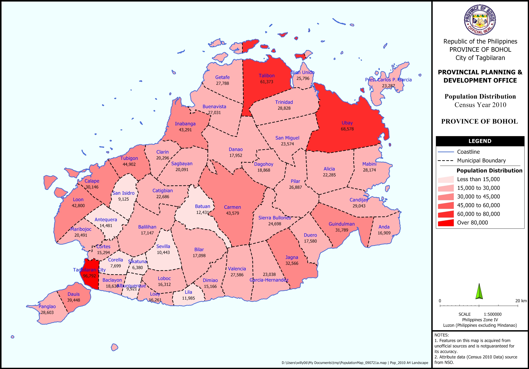
This Population Distribution Map – 2010 shows the population per municipality in color gradient based on the 2010 census from the National Statistics Office (NSO).
Available in JPG and PDF, this map may be downloaded and used for free provided that no alterations made to the map and that proper citations be referred to this source.

