
Download in PDF and JPG format
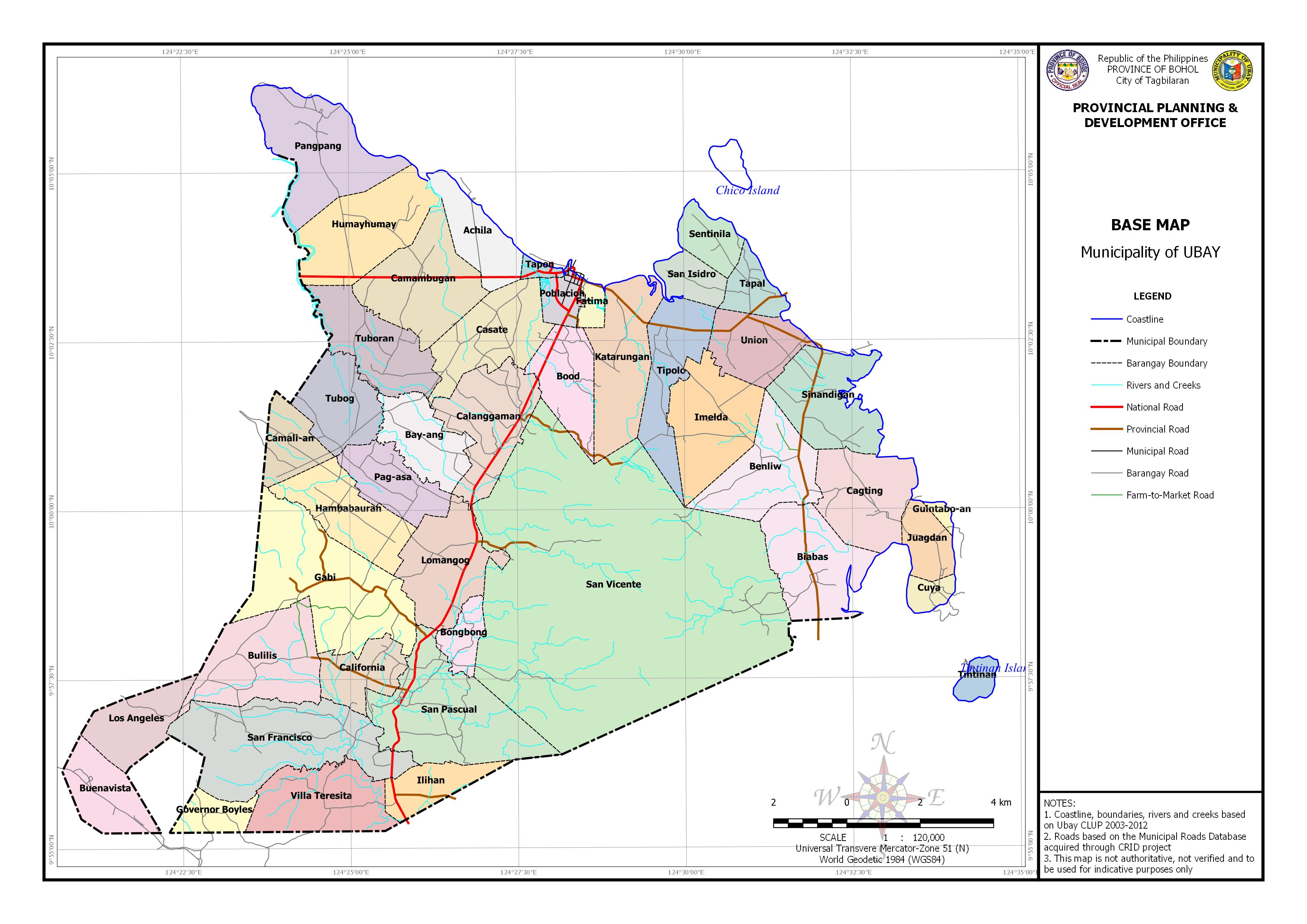
| Barangay | Area (ha) |
| Tubog | 451.619 |
| Tuboran | 559.370 |
| Hambabauran | 529.788 |
| Pag-asa | 384.338 |
| Bay-ang | 415.145 |
| Casate | 583.765 |
| Calanggaman | 626.032 |
| Bood | 416.584 |
| San Vicente | 5232.845 |
| Lomangog | 619.483 |
| San Pascual | 995.168 |
| Bongbong | 171.884 |
| California | 326.555 |
| Bulilis | 748.311 |
| San Francisco | 1124.516 |
| Los Angeles | 402.969 |
| Buenavista | 387.243 |
| Governor Boyles | 187.582 |
| Villa Teresita | 611.564 |
| Ilihan | 276.900 |
| Biabas | 651.773 |
| Cagting | 599.799 |
| Benliw | 601.747 |
| Sinandigan | 618.453 |
| Imelda | 665.930 |
| Union | 402.419 |
| Tipolo | 530.348 |
| Tapal | 204.493 |
| San Isidro | 196.710 |
| Katarungan | 662.961 |
| Pangpang | 802.227 |
| Tintinan | 101.455 |
| Guintabo-an | 34.340 |
| Cuya | 104.240 |
| Juagdan | 229.230 |
| Gabi | 1157.012 |
| Camali-an | 276.417 |
| Fatima | 79.998 |
| Poblacion | 146.363 |
| Tapon | 48.963 |
| Achila | 368.967 |
| Camambugan | 719.742 |
| Sentinila | 223.647 |
| Humayhumay | 739.160 |