
Download in PDF or in JPG format
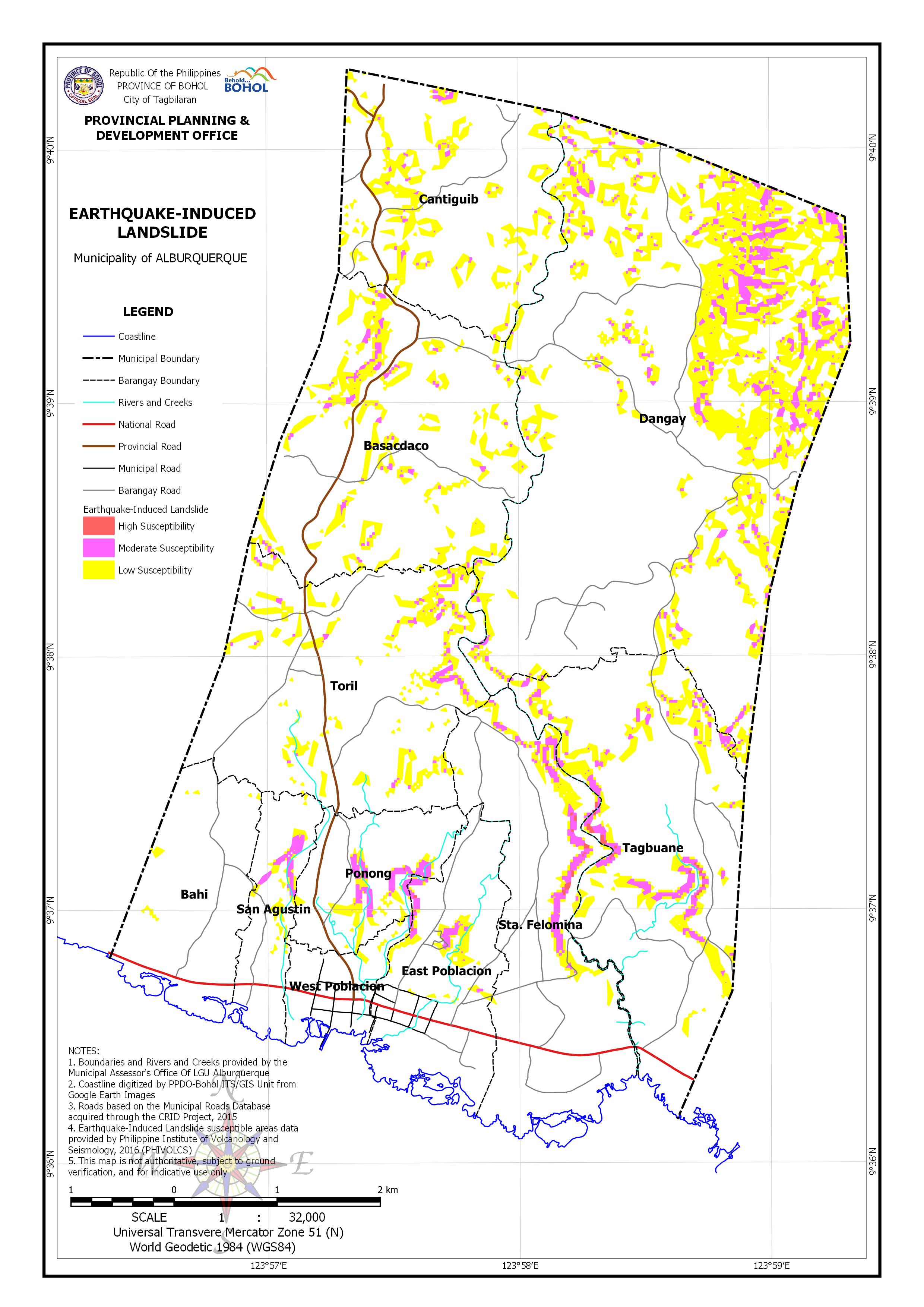
AREA EXPOSED TO EARTHQUAKE-INDUCED LANDSLIDE BY BARANGAY
| Barangay | Area | Area Exposed to High Susceptibility | Area Exposed to Moderate Susceptibility | Area Exposed to Low Susceptibility | |||
| (Hectares) | (Hectares) | (Percentage) | (Hectares) | (Percentage) | (Hectares) | (Percentage) | |
| Bahi | 131.978 | 0.812 | 0.62% | ||||
| Basacdaco | 320.521 | 5.39 | 1.68% | 34.774 | 10.85% | ||
| Cantiguib | 244.97 | 2.893 | 1.18% | 29.261 | 11.95% | ||
| Dangay | 815.135 | 0.08 | 0.01% | 39.169 | 4.81% | 150.349 | 18.45% |
| East Poblacion | 141.696 | 0.16 | 0.11% | 2.893 | 2.04% | 5.868 | 4.14% |
| Ponong | 89.032 | 0.04 | 0.05% | 4.913 | 5.52% | 5.928 | 6.66% |
| San Agustin | 65.521 | 2.579 | 3.94% | 3.088 | 4.71% | ||
| Sta. Felomina | 242.704 | 0.87 | 0.36% | 7.603 | 3.13% | 11.591 | 4.78% |
| Tagbuane | 319.398 | 1.004 | 0.31% | 11.717 | 3.67% | 30.597 | 9.58% |
| Toril | 308.17 | 4.805 | 1.56% | 25.944 | 8.42% | ||
| West Poblacion | 47.003 | 0.026 | 0.06% | 0.206 | 0.44% | 0.632 | 1.35% |
| Total | 2,726.13 | 2.18 | 0.08% | 82.168 | 3.01% | 298.843 | 10.96% |