
Download in PDF and JPG format
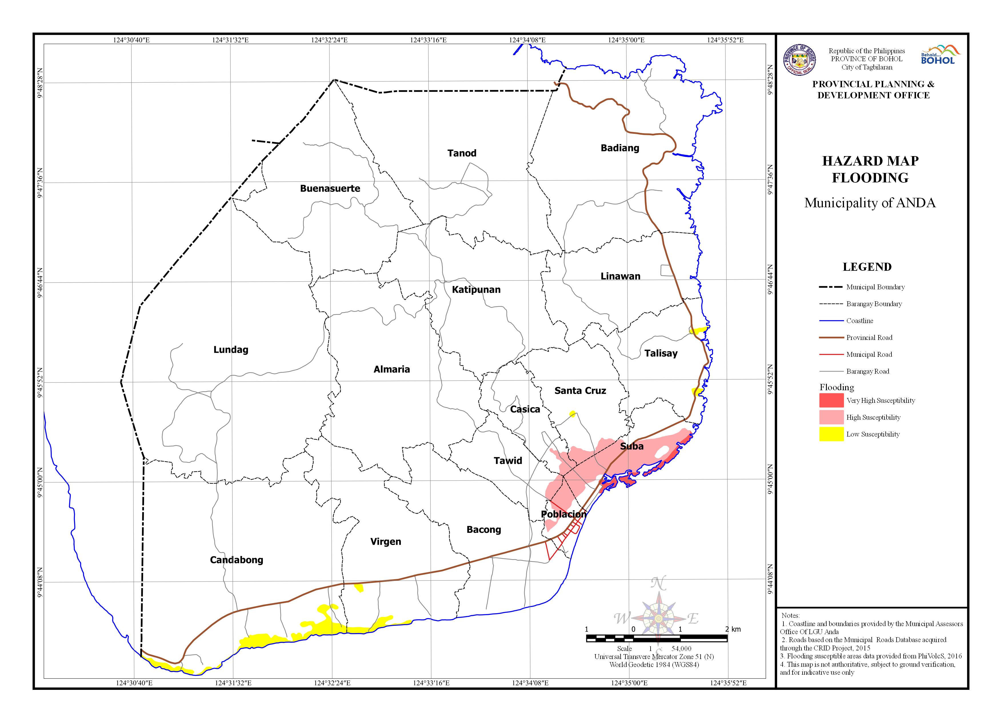
AREA EXPOSED TO FLOODING BY BARANGAY
| Barangay | Area | Area Exposed to Very High Susceptibility | Area Exposed to High Susceptibility | Area Exposed to Low Susceptibility | Area Not Exposed | ||||
| (Hectares) | (Hectares) | Percentage | (Hectares) | Percentage | (Hectares) | Percentage | (Hectares) | Percentage | |
| Tawid | 142.246 | 5.973 | 4.199% | 136.274 | 95.801% | ||||
| Katipunan | 437.769 | 437.769 | 100.000% | ||||||
| Santa Cruz | 211.921 | 10.829 | 5.110% | 0.599 | 0.283% | 200.493 | 94.608% | ||
| Talisay | 242.032 | 3.408 | 1.408% | 238.624 | 98.592% | ||||
| Candabong | 913.208 | 36.128 | 3.956% | 877.079 | 96.044% | ||||
| Bacong | 384.549 | 384.549 | 100.000% | ||||||
| Poblacion | 51.421 | 14.854 | 28.886% | 36.568 | 71.114% | ||||
| Casica | 127.206 | 7.468 | 5.871% | 119.738 | 94.129% | ||||
| Suba | 150.647 | 13.529 | 8.980% | 71.463 | 47.437% | 65.655 | 43.582% | ||
| Tanod | 611.43 | 611.43 | 100.000% | ||||||
| Linawan | 308.36 | 308.36 | 100.000% | ||||||
| Buenasuerte | 483.765 | 483.765 | 100.000% | ||||||
| Lundag | 1114.256 | 1114.256 | 100.000% | ||||||
| Almaria | 586.18 | 586.18 | 100.000% | ||||||
| Virgen | 438.871 | 9.532 | 2.172% | 429.339 | 97.828% | ||||
| Badiang | 681.255 | 681.255 | 100.000% | ||||||
| Total | 6885.115 | 13.529 | 0.196% | 110.585 | 1.61% | 49.667 | 0.721% | 6711.334 | 97.476% |