
Download in PDF and JPG format
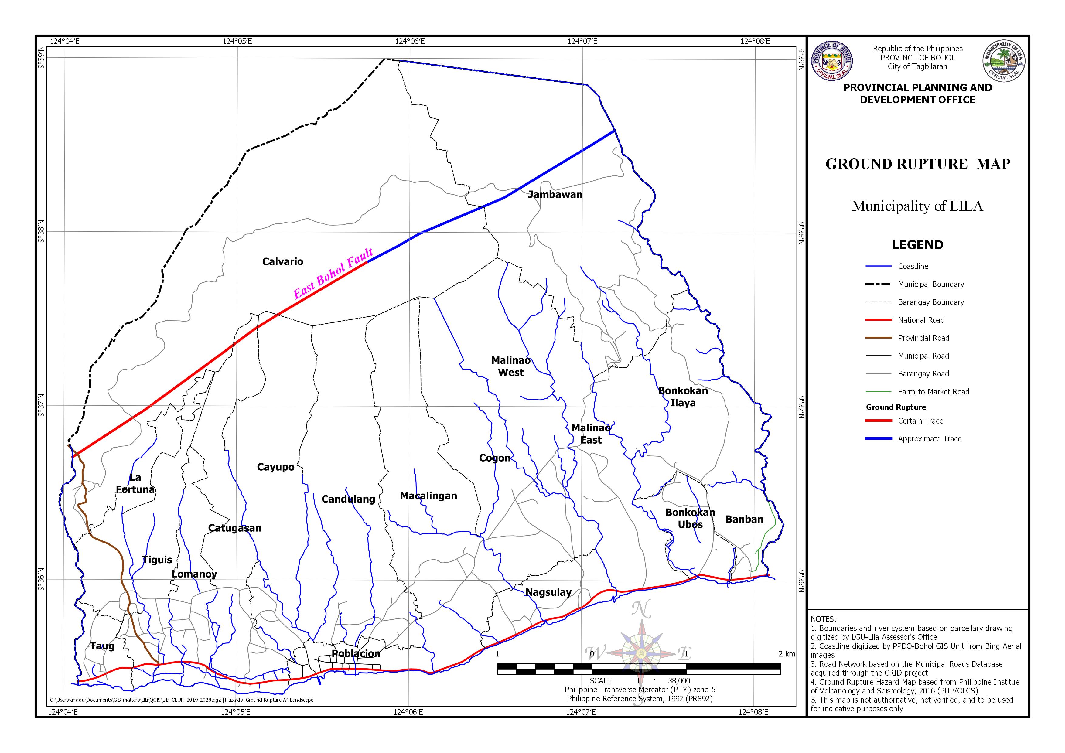
The map shows the area exposed to Ground Rupture, which the East Bohol Fault transverse some barangays in Certain and Approximate fault. Ground Rupture Hazard Map-based from Philippine Institute of Volcanology and Seismology (PHILVOCS). This map is not authoritative, not verified, and to be used for indicative purposes only.
| FAULT_NAME | TRACE_TYPE | LINE_TYPE | PROJECT | YR_MAPPED |
| East Bohol Fault | Certain | Solid | READY | 2007 |
| East Bohol Fault | Approximate | Dashed | READY | 2007 |
| East Bohol Fault | Approximate | Dashed | READY | 2007 |
| East Bohol Fault | Approximate | Dashed | READY | 2007 |
| East Bohol Fault | Certain | Solid | READY | 2007 |
| East Bohol Fault | Certain | Solid | READY | 2007 |
| East Bohol Fault | Certain | Solid | READY | 2007 |