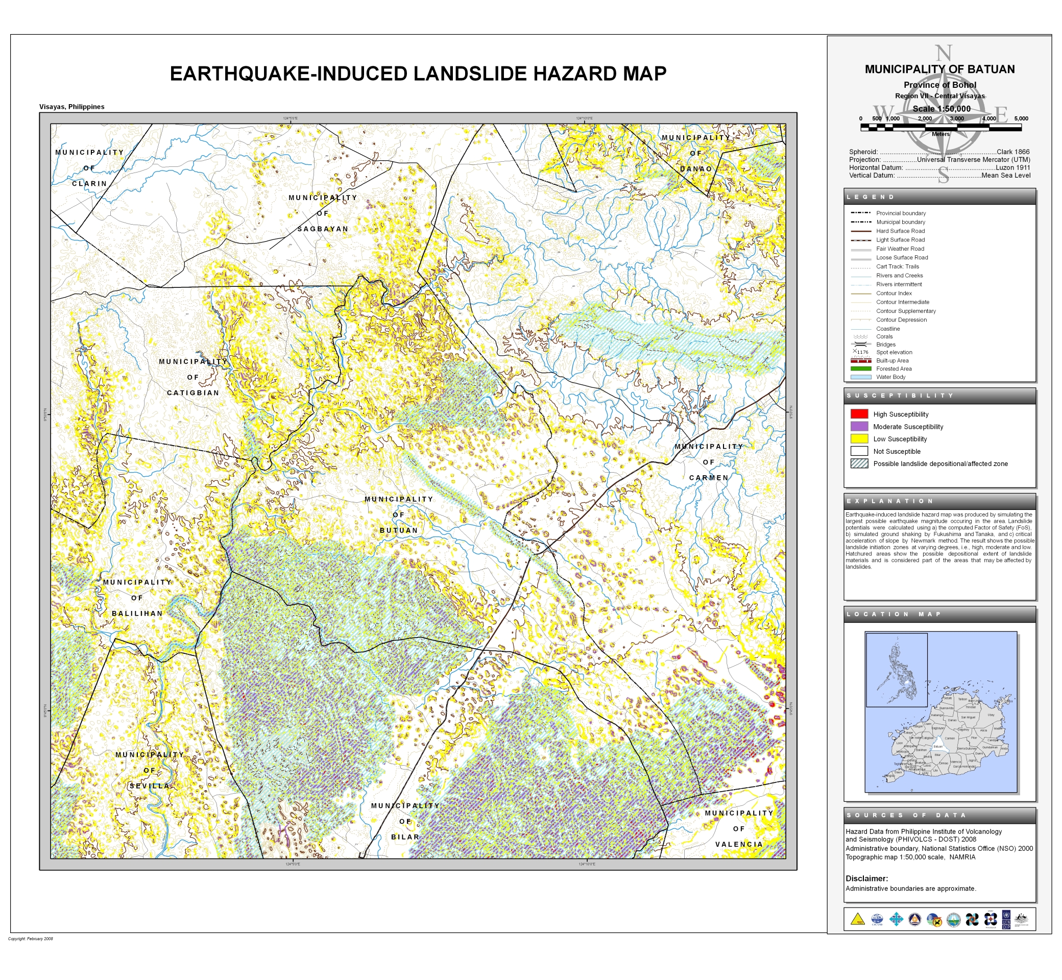
The Earthquake-Induced Landslide Map of Batuan also partially covers the municipality of:
- Balilihan
- Bilar
- Carmen
- Catigbian
- Clarin
- Danao
- Sagbayan
- Sevilla
- Valencia

Provincial Planning and Development Office
The Earthquake-Induced Landslide Map of Batuan also partially covers the municipality of: