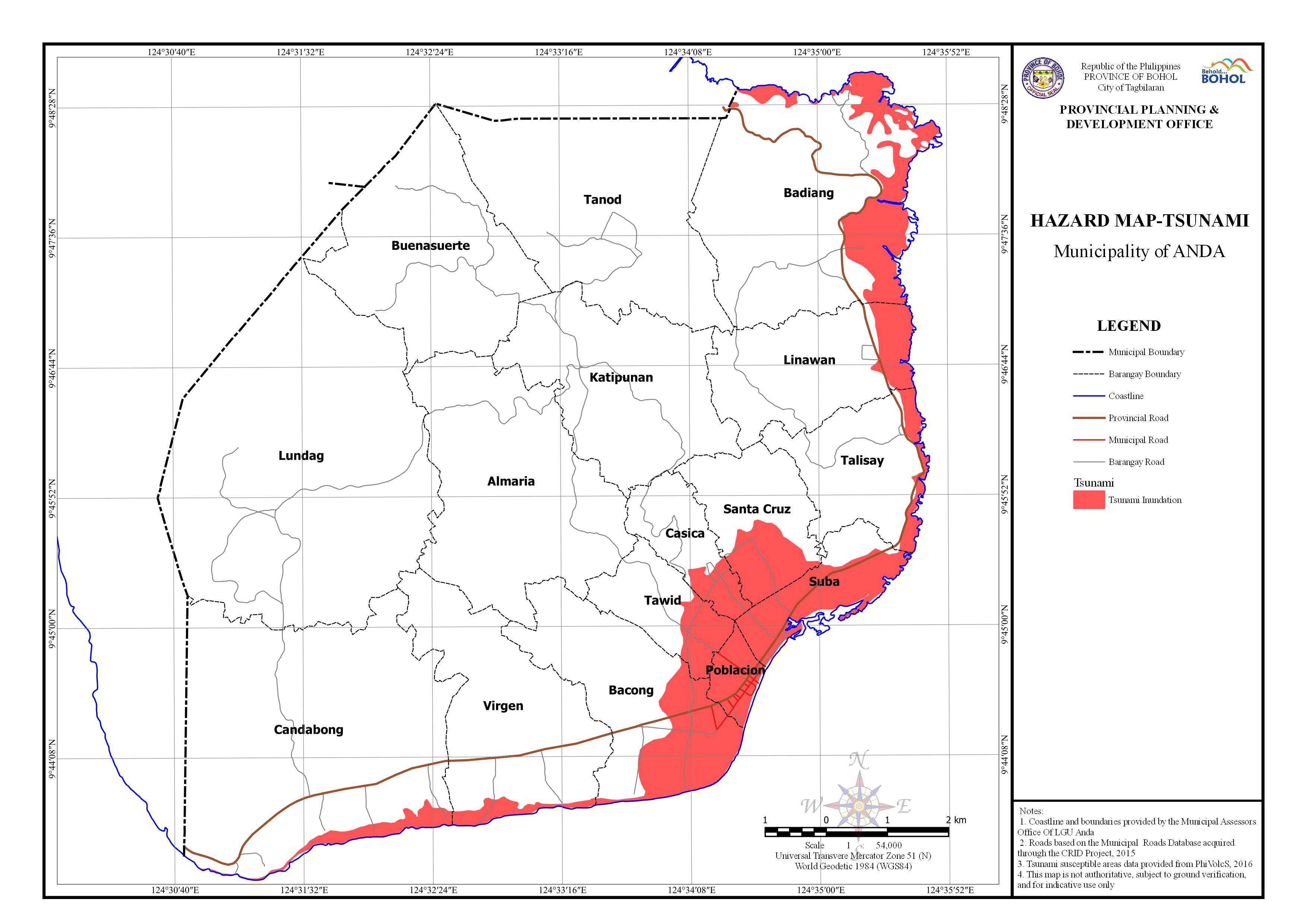
Download in PDF and JPG format
AREA EXPOSED TO TSUNAMI BY BARANGAY
| Barangay | Area | Area Exposed to Tsumi Inundation | |
| (Hectares) | (Hectares) | Percentage | |
| Almaria | 586.18 | ||
| Bacong | 384.549 | 127.422 | 33.14% |
| Badiang | 681.255 | 132.631 | 19.47% |
| Buenasuerte | 483.765 | ||
| Candabong | 913.208 | 30.092 | 3.30% |
| Casica | 127.206 | 31.653 | 24.88% |
| Katipunan | 437.769 | ||
| Linawan | 308.36 | 41.481 | 13.45% |
| Lundag | 1,114.26 | ||
| Poblacion | 51.421 | 48.867 | 95.03% |
| Santa Cruz | 211.921 | 64.793 | 30.57% |
| Suba | 150.647 | 109.514 | 72.70% |
| Talisay | 242.032 | 26.178 | 10.82% |
| Tanod | 611.43 | ||
| Tawid | 142.246 | 43.064 | 30.27% |
| Virgen | 438.871 | 20.799 | 4.74% |
| Total | 6,885.12 | 676.493 | 9.83% |

