Download in PDF or in JPG formats
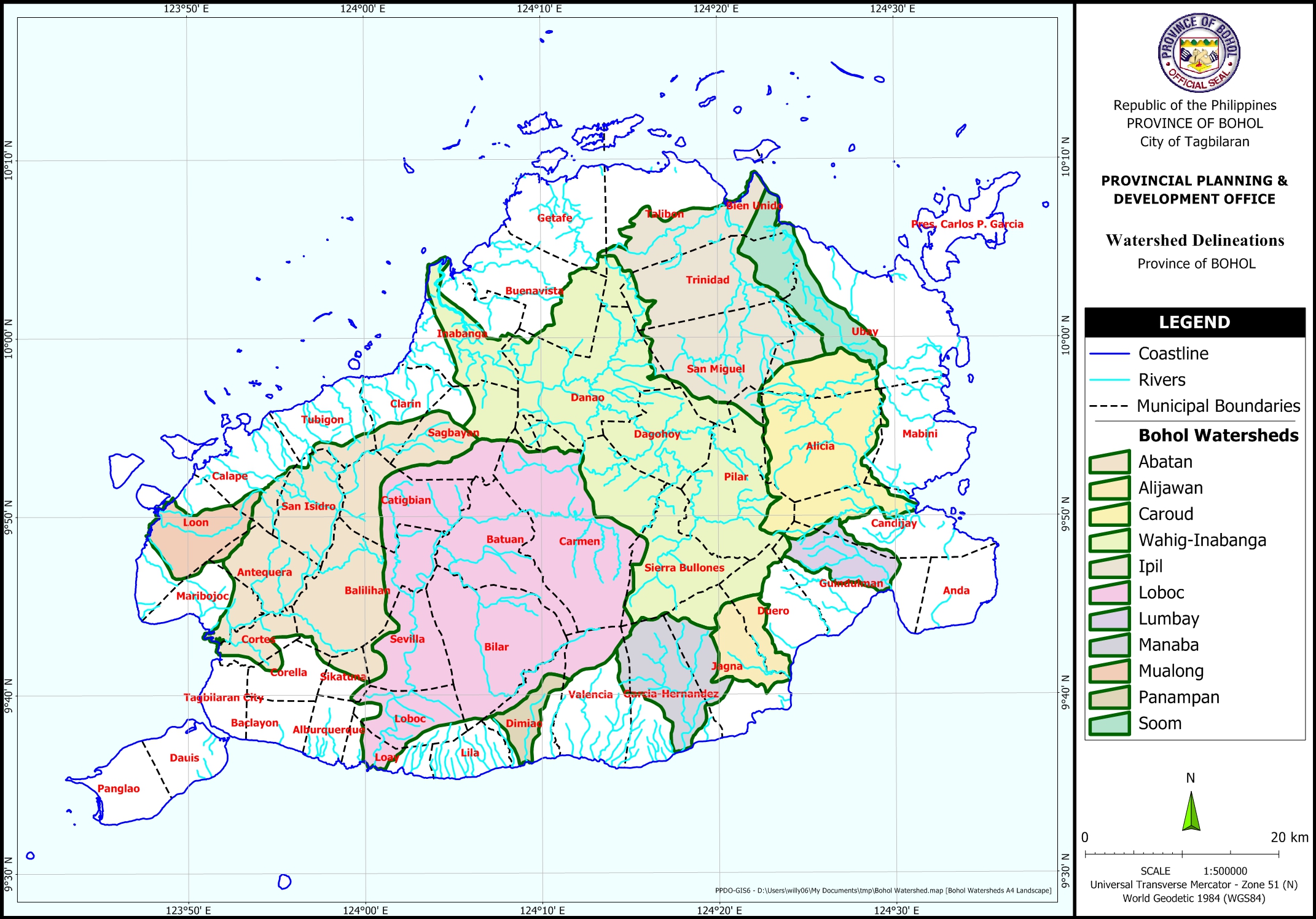
The Watershed Delineation Map shows areas according to the different watersheds of the Province of Bohol. The watershed delineation was acquired from the Environmental Science for Social Change. Base map features were digitized from the National Mapping and Resource Information Authority (NAMRIA) Topographic Map sheets scaled at 1:50,000 using heads-up digitizing method.
Available in PDF and JPG formats, this map may be downloaded and used for free provided that no alterations are made to the map and that proper citations be referred to this source.


Thanks as useful in myclass in engineering hydrology.
You’re welcome
Good afternoon po, may I ask if you have Digital Elevation Model (DEM) sa Lumbay watershed? Thank you.
Hi Marne, a Digital Elevation Model of the Province of Bohol is uploaded HERE. It is extracted and reprojected from SRTM v3 1-arc-second. You may have to extract further to your area of interest.
Hello! Can I request the shapefile of the watershed delineations used in this map? Thank you!
We’re sorry we have restrictions from the source of that shapefile. You may have to digitize the map to generate your own file. The data is also a bit old and more accurate sources may already exist and updates may already be available. You may access them through DENR, BSWM, or maybe NAMRIA.
Perhaps you can also generate your own through a freely distributed digital elevation model of the SRTM.
Thank you for your interest in the Province of Bohol.
Hello! By any chance, can we get the rainfall data for Bohol from year 2000-2022 here? We need it for our hydrology class. Thank you!
We’re sorry we don’t have such data. You might want to refer your query to PAGASA.