
Maps available for download
 | Basic Maps
Basic Maps contain basic features and may be used to build other maps or just for reference purposes. |
 | Development Maps
The maps herein are outputs of different development planning activities. |
 | Facilities Maps
The maps herein show location and status of various facilities in the province of Bohol |
 | Hazard Maps
These Hazard Maps were acquired from the Hazards Mapping and Assessment for Effective Community-Based Disaster Risk Management (READY) Project through the Philippine Institute of Volcanology and Seismology (PhIVolcS). |
 | Statistical Maps
These maps were generated using statistical data. |
 | Thematic Maps
A thematic map is a type of map or chart especially designed to show a particular theme connected with a specific geographic area. (Wikipedia) |
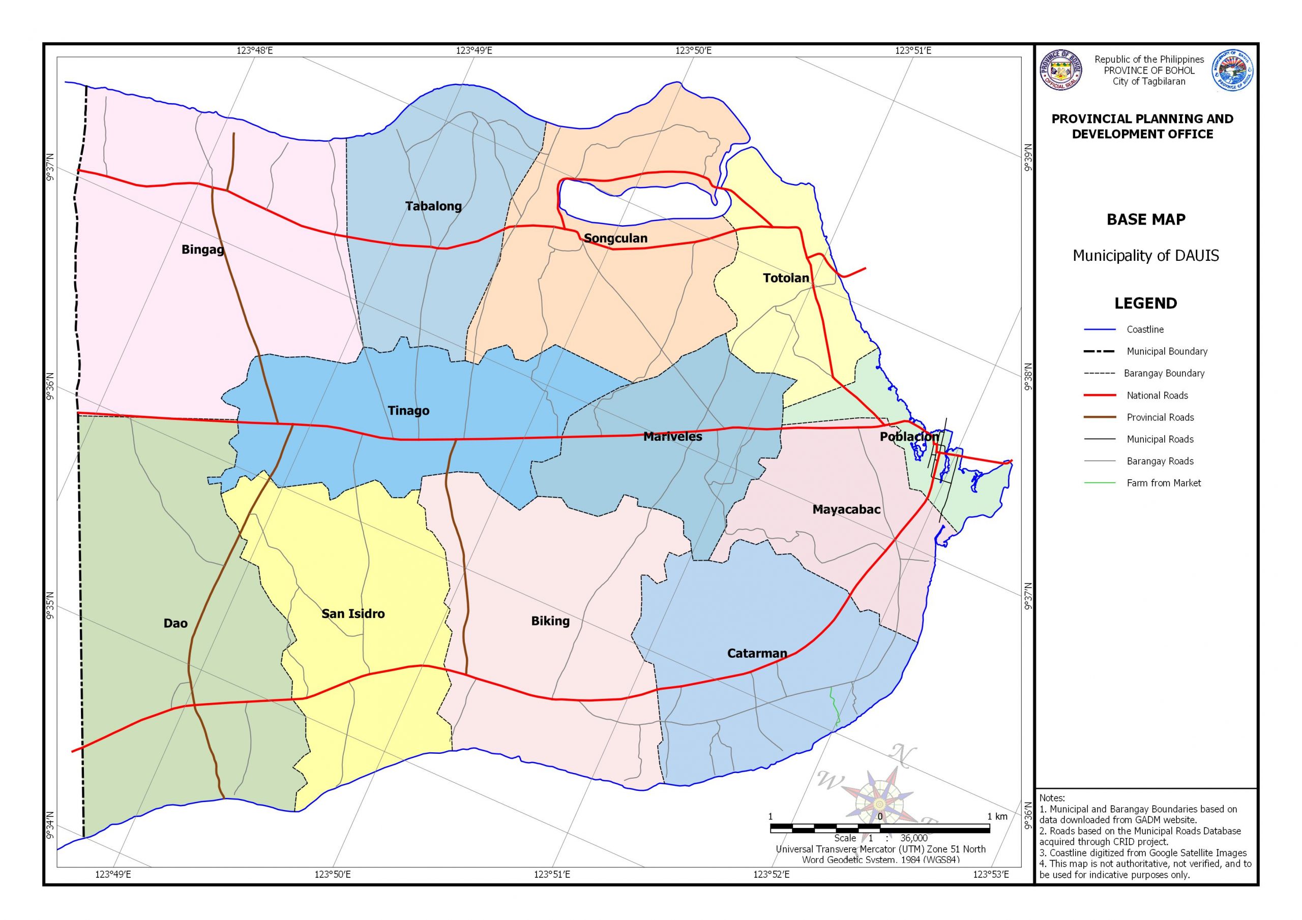 | Municipal Maps |
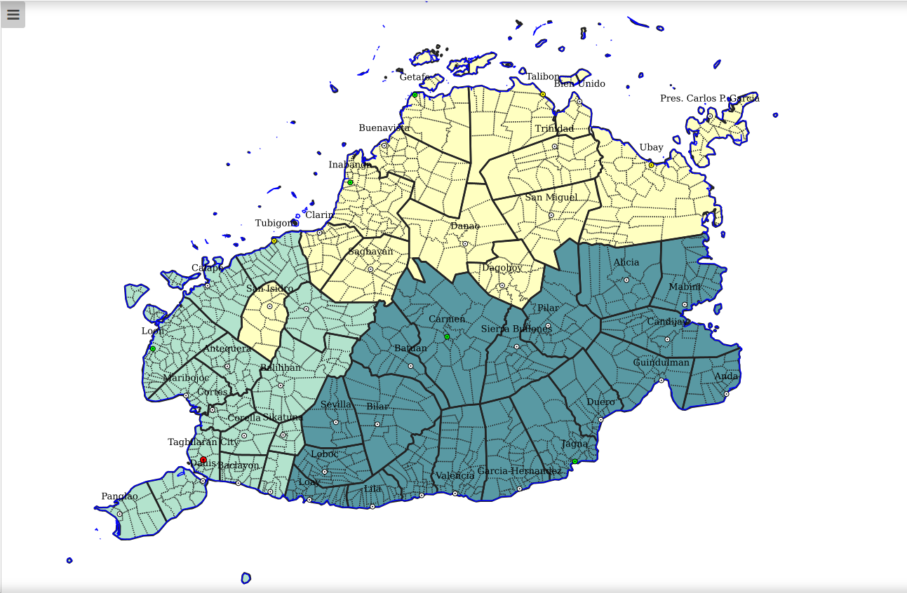 | Interactive Web Map |
Good day!
I am the Regional Monitoring and Evaluation Officer III of Kalahi CIDSS – NCDDP in Region VII. As part of our data collection and analysis, we have used the capabilities of smartphone devices to get the exact location of our subprojects through the use of a technique known as geotagging. In connection with this, may I ask your good office if you have an available Boundary Map up to the barangay level in shapefile format. This will allow us to create Hazard maps using your official boundary map used in the province to give us better visual reference for presentation and for analytical purposes.
If it happen that this data is available in your office, please let me know how I can get/acquire the data from your office through my email, my mobile number, and our office number in Cebu City. Hoping that you consider our request.
Thank you very much!
Sincerely,
Nelmar D. Babor
Regional M&E Officer III
Kalahi CIDSS – NCDDP
DSWD FO 7
Hi Nelmar,
We’re sorry PPDO-Bohol does not have such data. We are only using the administrative boundaries that we have downloaded from the GADM Website. However, I heard some municipalities had received hard copies as well as CAD files of the Political Boundary Survey (PBS) conducted by DENR, which I think is much more accurate than GADM. Perhaps you can inquire from the municipalities of your project coverage if they have those. You may also inquire from DENR if they have those files.
ok
ok what?
@Willy Bueno,
Thank you sir for your reply. Just checked this thread, and it was a while. I have already asked the DENR but they don’t have “official” boundary map that they can give us, further stating that even in their thematic maps, they do not put boundaries. Again, your reply is very much appreciated, thank you!
PS: I don’t know who replied the “ok” comment…
Good day Sir. Pwede mangayu’g map sa Valencia, Bohol with its barangay?
Need gyud jamo para sa akong thesis.
Salamat Sir.
Hi, you may access Valencia Base Map from HERE.