| Contour Interval Download in PDF and JPG format | |
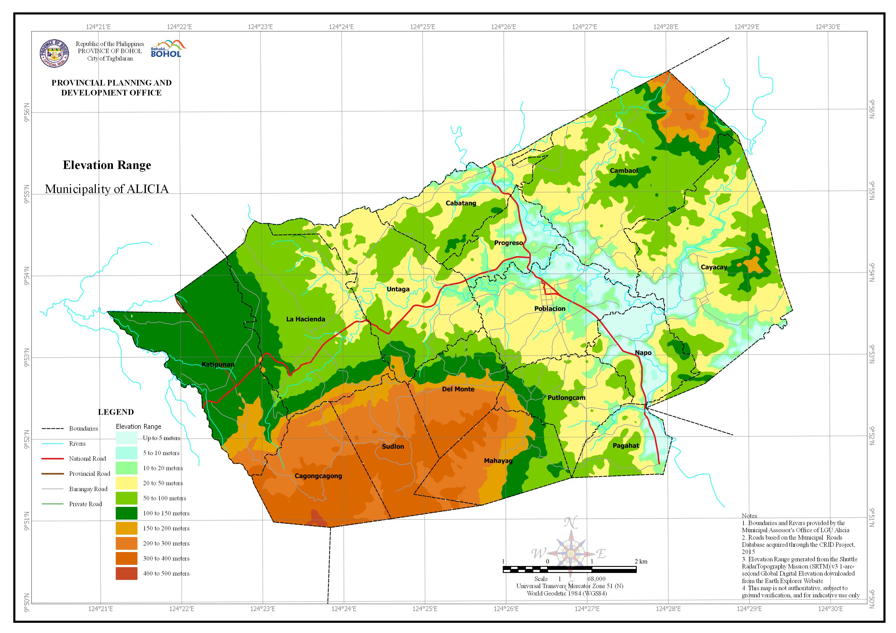 | Elevation Range Download in PDF and JPG format |
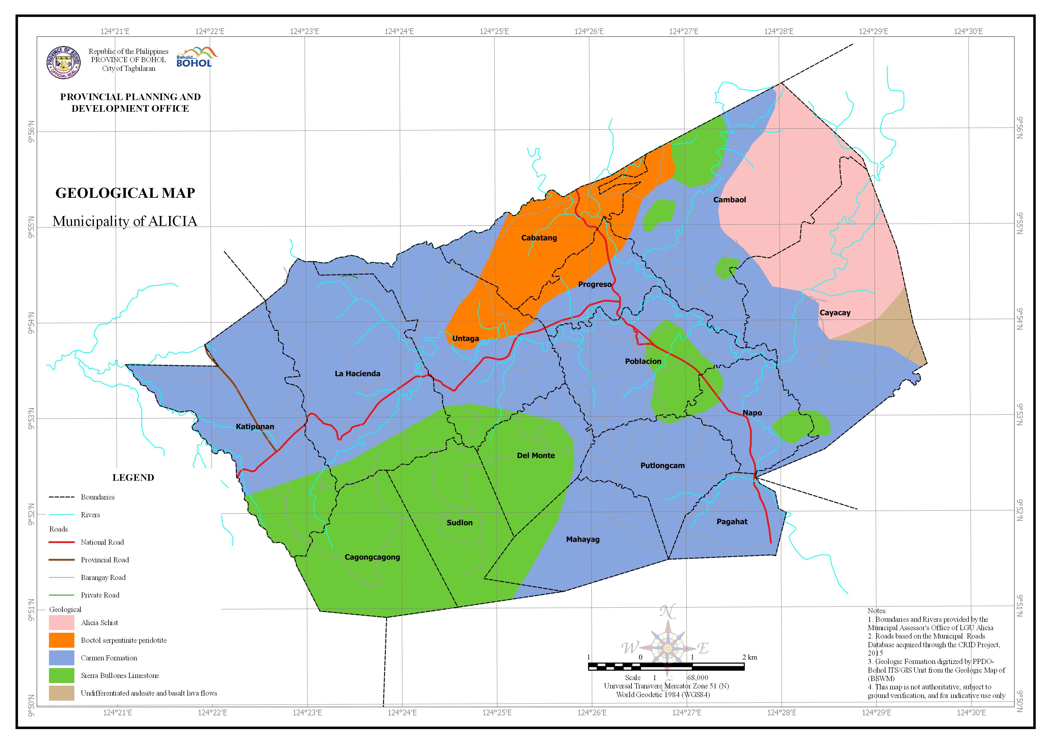 | Geological Download in PDF and JPG format |
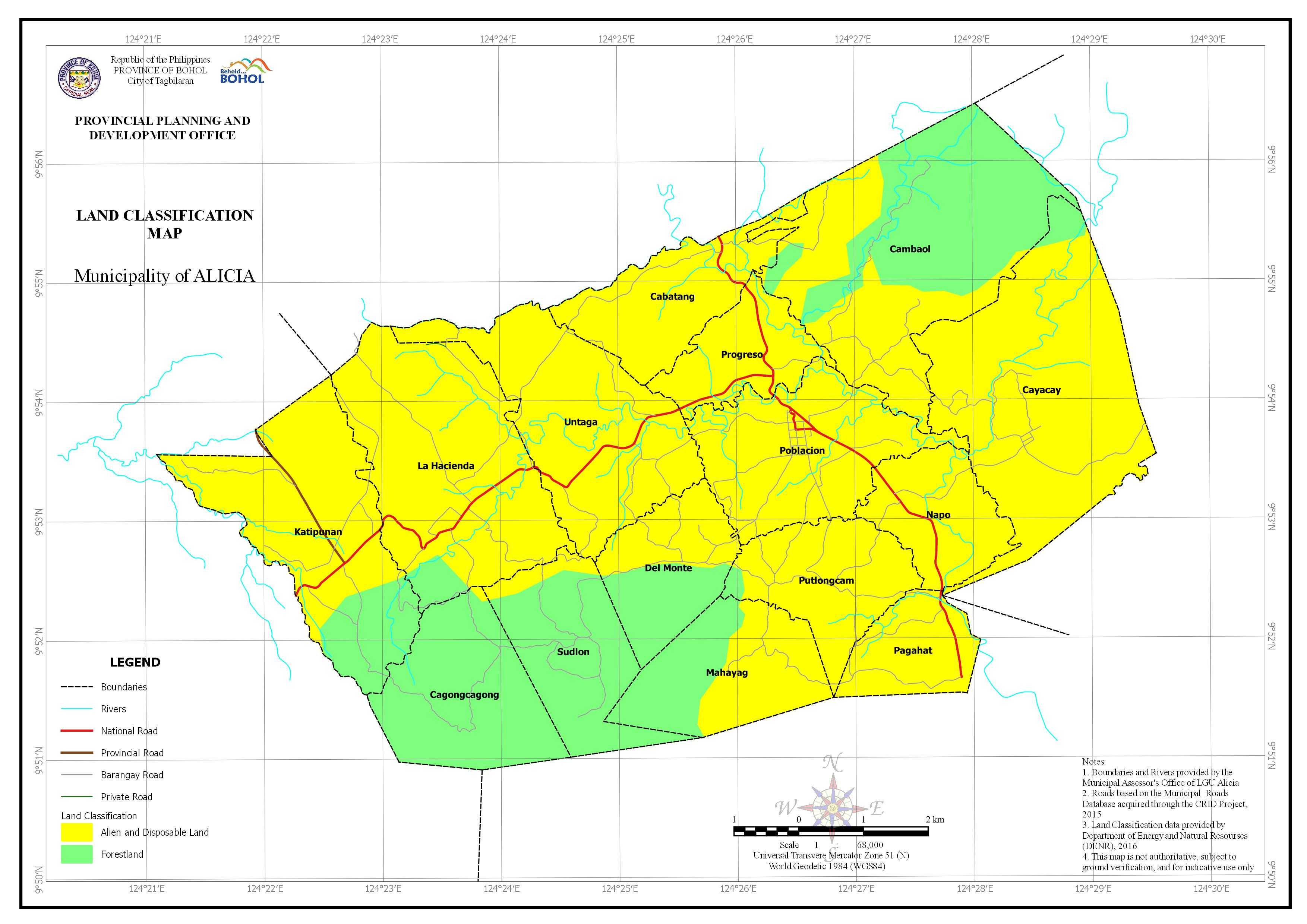 | Land Classification Download in PDF and JPG format |
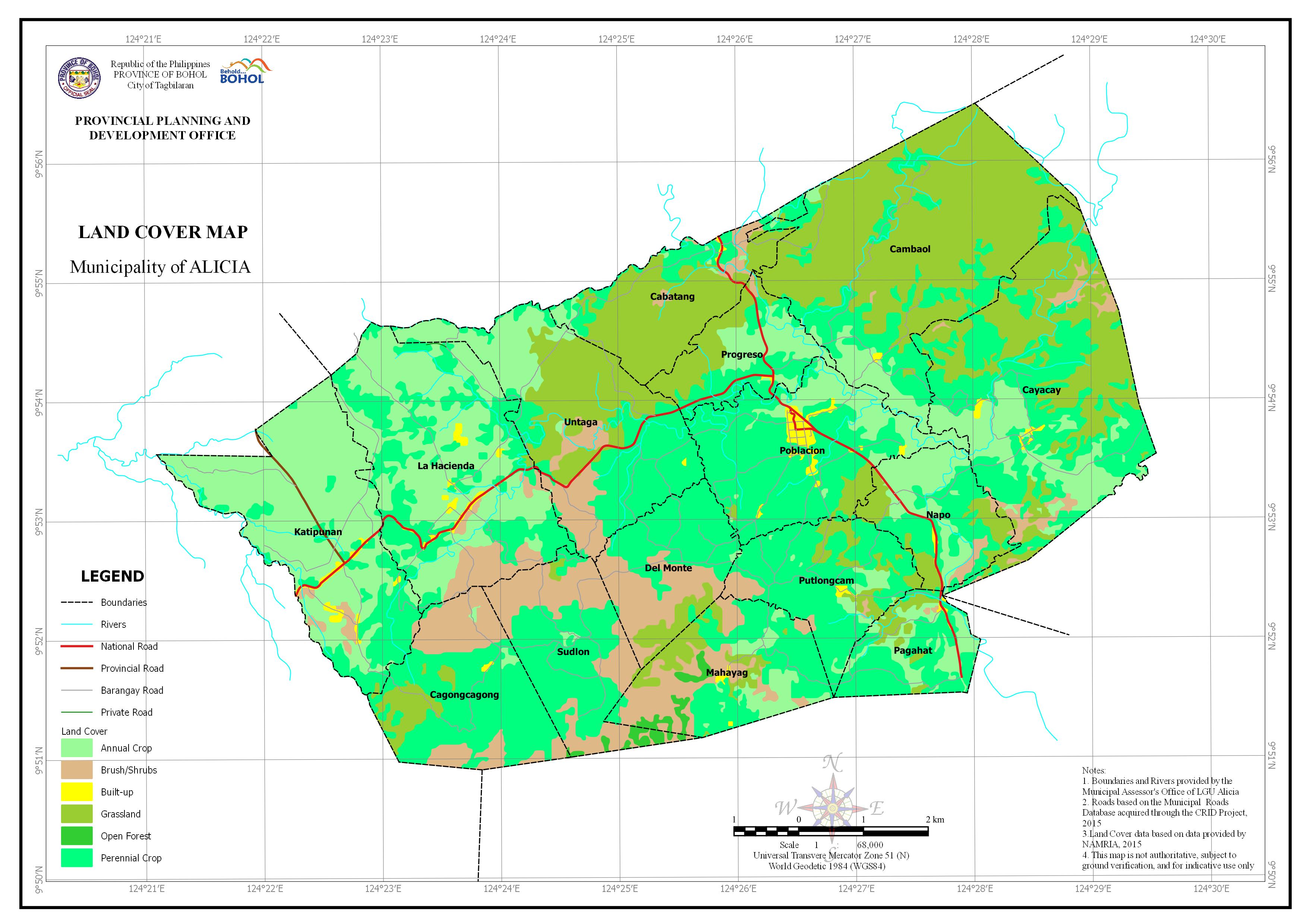 | Land Cover Download in PDF and JPG format |
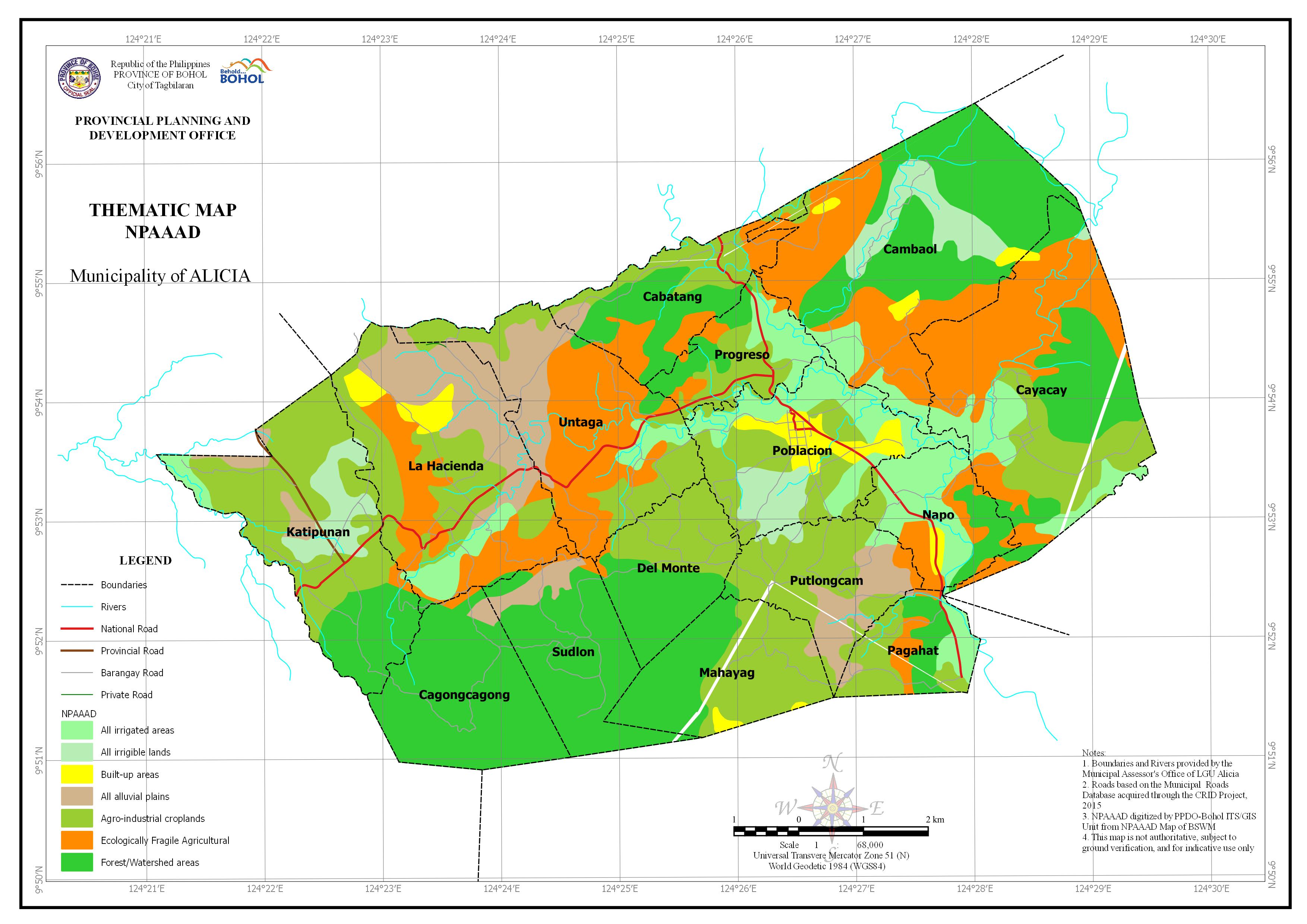 | Network of Protected Areas for Agriculture and Agro-Industrial Development Map (NPAAAD) Download in PDF and JPG format |
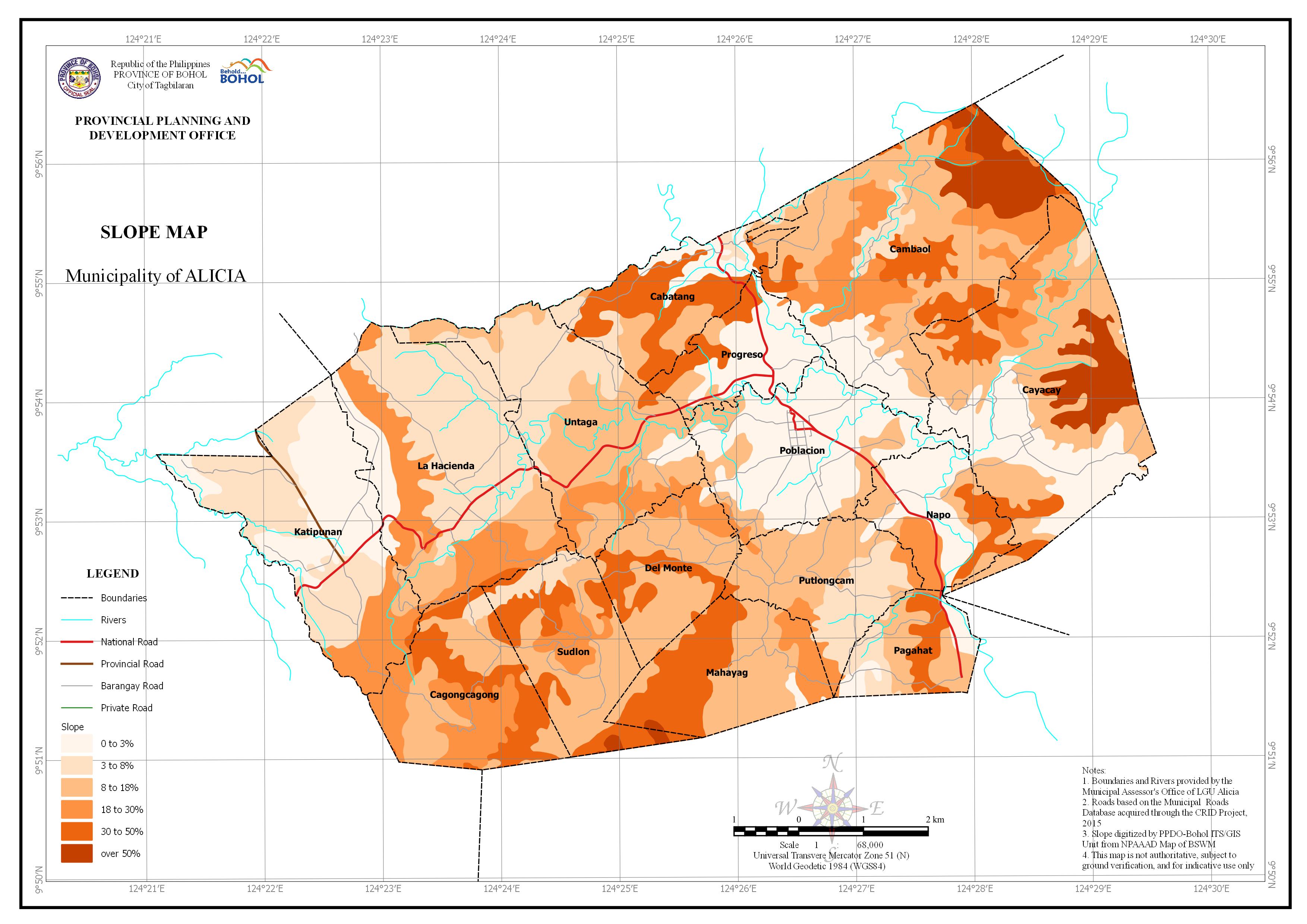 | Slope Download in PDF and JPG format |
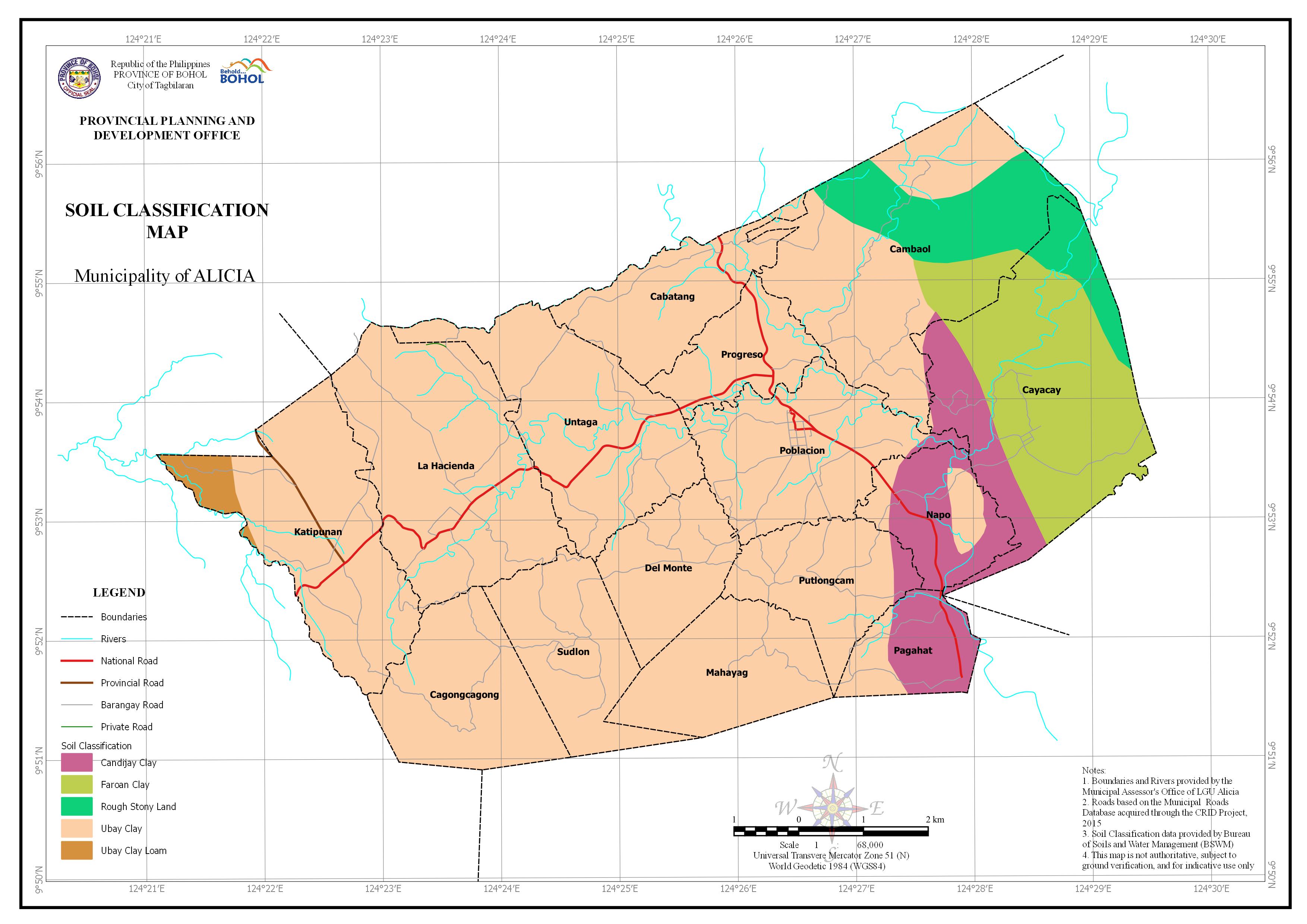 | Soil Classification Download in PDF and JPG format |
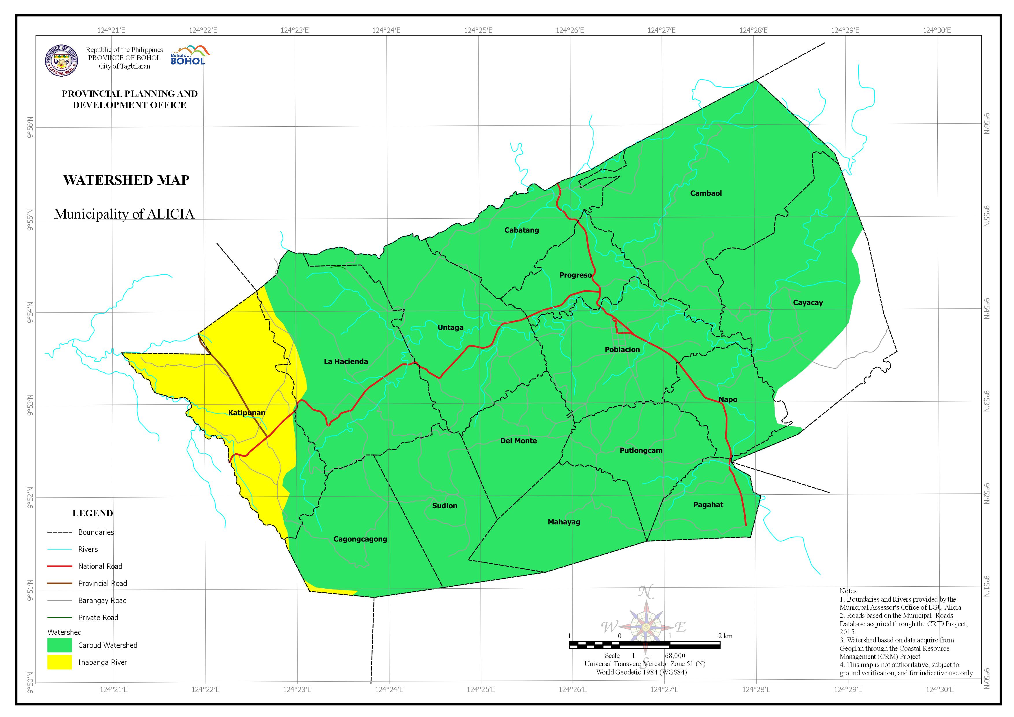 | Watershed Download in PDF and JPG format |

Provincial Planning and Development Office