Skip to content

Note

Note: When navigating the menu using a desktop computer, just hover the mouse cursor over the menu to see sub-menu. Otherwise, click the arrow down icon when using mobile and tablet devices.

PPDO BOHOL

PPDO BOHOL

Provincial Planning and Development Office

  • Home
  • About
    • Citizen’s Charter
      • External Services
      • Internal Services
    • PPDC Page
    • Sectors
      • Special Unit
        • BIWRMT
          • Clean Water Act
        • Project Development Unit
          • Project Development Monitoring Unit (PDMU) personnel
        • Geographic Information System Unit
          • GIS Equipments
          • Geographic Information System (GIS) Unit Personnel
            • GIS Unit Tasks
        • ODA/Foreign Affairs Unit
          • Official Development Assistance Unit (ODA-IR) Personnel
      • Social Development Sector
        • Social Sector Personnel
      • Economic Development Sector
        • Economic Development Sector Personnel
      • Development Administration Sector
        • Development Administration Sector Personnel
      • Environment Management Sector
        • Environment Management Sector personnel
      • Infrastructure Development Sector
        • Infrastructure Development Sector Personnel
      • Administrative Division
        • Administrative Services
          • Printing and Photocopying Fees
        • Administrative Division Personnel
        • Administrative Reports
  • Profile
    • Socio Economic Profile
      • Environment and Natural Resource Management
        • Biodiversity Management
        • Natural Resource Management
        • Land Resource Management
        • Forestry
        • Water Resource Management
        • Mineral Resource Management
        • Coastal Resource Management
        • Urban Environment
      • Development Administration
        • Public Finance
          • Income Classification of the Province, City, and Municipalities
          • Internal Revenue Allotment (IRA) of Bohol LGUs (2011-2016)
        • Local Governance
          • Libraries and Reading Centers (2015)
          • Inventory of Sports / Recreational Facilities in the Province of Bohol
          • Local Special Bodies 2015
          • Civil Society Organization (CSO) Accreditation
            • Accredited CSOs 2022-2025
            • Accredited CSOs 2019-2022
            • Accredited CSOs 2016-2019
            • Accredited CSOs 2013-2016
            • Accredited CSOs 2010-2012
        • Justice and Safety
          • Fire Incidence & Protection Services
            • Fire-Fighting Force and Facilities (As of December 2015)
            • Fire Incidence – Province of Bohol (2012-2015)
            • Fire Incidents per Municipality/ City 2012-2015
          • Crime Statistics and Police Force
            • Crime Volume Bohol Province (2014-2017)
          • Jail Management
            • Rehabilitation and Detention Services (2015)
            • Rehabilitation and Detention Services (2014)
          • Judiciary Services
      • Infrastructure Development
        • Transport and Access
          • Roads and Bridges
          • Seaport
          • Airport
          • Land Transportation Office (LTO)
        • Water and Irrigation
          • Water and Irrigation
        • Power and Energy
          • Power and Energy 2023
        • Communication
      • Economic Development
        • Trade and Industry
          • Number, Area and Description of Markets by Municipality
        • Agriculture
          • Crops
            • Palay and Corn
            • Commercial Crops
            • Vegetables
            • Fruits
            • Root Crops
            • Ornamentals
          • Livestock
          • Fisheries
            • Commercial Fisheries
            • Inland Municipal Fisheries
            • Marine Municipal Fisheries
            • Aquaculture
        • Tourism
          • Visitor Arrivals
          • Tourist Attractions
      • Social Development
        • Health & Nutrition
        • Social Welfare
        • Education
        • Culture & Arts
        • Housing
    • Bohol Poverty Profile
      • Poverty Database Monitoring System (PDMS)
    • Bohol Quick Profile
      • Location Map
      • Fast Facts about Bohol
      • Provincial Symbols
      • Bohol An Area Profile
        • Provincial Capital/Administrative Units
        • Population & Human Development
        • Location & Accessibility
        • History/Language/Climate
        • Geographical and Resource Endowment
        • Socio-economic Situationer
        • Infrastructure
        • The Economy & Agricultural Productivity
        • Investments
        • Tourism
        • Social Services, Amenities & Development
      • Bohol’s Development Potentials
      • Bohol’s Development Challenges
      • Bohol’s Development Path
        • Overall Development Framework
        • The Bohol Poverty Framework
      • Development Directions & Policies
      • Major Breakthroughs/Local Initiatives
    • Municipalities
      • 1st District
        • Tagbilaran
        • Alburquerque
        • Antequera
        • Baclayon
        • Balilihan
        • Calape
        • Catigbian
        • Corella
        • Dauis
        • Cortes
        • Loon
        • Maribojoc
        • Panglao
        • Sikatuna
        • Tubigon
      • 2nd District
        • Bien Unido
        • Buenavista
        • Clarin
        • Dagohoy
        • Danao
        • Inabanga
        • Getafe
        • Pres. Carlos P. Garcia
        • Sagbayan
        • San Isidro
        • San Miguel
        • Talibon
        • Trinidad
        • Ubay
      • 3rd District
        • Alicia
        • Anda
        • Batuan
        • Bilar
        • Candijay
        • Carmen
        • Dimiao
        • Duero
        • Garcia Hernandez
        • Guindulman
        • Loboc
        • Jagna
        • Lila
        • Mabini
        • Pilar
        • Sevilla
        • Sierra Bullones
        • Valencia
        • Loay
  • Projects
    • Bohol Energy Development Advisory Group (BEDAG)
      • BEDAG Technical Bulletin
        • BEDAG Technical Bulletin No. 1-2015
        • BEDAG Technical Bulletin No. 2-2015
  • PDC Matters
    • PDC Resolutions Series of 2017
    • PDC Resolutions Series of 2018
    • PDC Resolutions Series of 2019
    • PDC Resolutions Series of 2020
    • PDC Resolutions Series of 2021
    • PDC Resolutions Series of 2022
    • PDC Resolutions Series of 2023
    • PDC Resolutions Series of 2024
  • Provincial Atlas
    • Basic Maps
      • Bohol Base Map
      • Location Map
      • Bohol Districts Map
    • Development Maps
      • Development Constraints
      • Land Use Map
      • Development Opportunities Map
    • Facilities Maps
      • Road Network
        • Road Surface Type Map
        • PRMF Rehabilitation Map
        • Road Network Map
        • Road Management Unit
        • Road Condition Map
        • Traffic Count Map
    • Shapefiles
      • Base Map Shapefiles
      • Hazards
      • Thematics
    • Municipal Maps
      • 1st District
        • Alburquerque
          • Base Map
          • Hazard Maps
            • Earthquake-Induced Landslide
            • Flooding
            • Ground shaking
            • Liquefaction
            • Rain-Induced landslide
            • Storm Surge
            • Tsunami
          • Statistical Maps
            • Annual Growth Rate
            • Population Change
            • Population Density
            • Population Distribution
          • Thematic Maps
            • Contour Interval Map
            • Elevation Range
            • Geologic Formation
            • Land Classification
            • Land Cover
            • Network of Protected Areas for Agriculture and Agro-Industrial Development (NPAAAD)
            • Slope
            • Soil Classification
        • Antequera
          • Basic Maps
          • Hazard Maps
          • Statistical Maps
          • Thematic Maps
        • Baclayon
          • Basic Maps
          • Hazard Maps
          • Statistical Maps
          • Thematic Maps
        • Balilihan
          • Basic Maps
          • Hazard Maps
          • Statistical Maps
          • Thematic Maps
        • Calape
          • Basic Maps
          • Hazard Maps
          • Statistical Maps
          • Thematic Maps
        • Catigbian
          • Basic Maps
            • Base Map
            • Location Map
          • Hazard Maps
            • Earthquake-Induced Landslide
            • Flooding
            • Ground Shaking
            • Rain-Induced Landslide
          • Statistical Maps
            • Population Density
            • Projected Population Density
            • Population Growth Rate
            • Population Temporal Change
            • Population Distribution
          • Thematic Maps
            • Land Classification
            • Geologic Formation
            • Land Cover
            • Slope
            • Soil
            • Watershed
        • Corella
          • Basic Maps
          • Hazard Maps
          • Statistical Maps
          • Thematic Maps
        • Cortes
          • Basic Maps
          • Hazard Maps
          • Statistical Maps
          • Thematic Maps
        • Dauis
          • Base Map
          • Hazard Maps
            • Earthquake-Induced Landslide
            • Flooding
            • Liquefaction
            • Rain-Induced Landslide
            • Storm Surge
            • Tsunami
          • Statistical Maps
            • Population Distribution
            • Population Density
            • Population Change
            • Annual Growth Rate
          • Thematic Maps
            • Geological Formation
            • Land Classification Map
            • Network of Protected Areas for Agriculture and Agro-Industrial Map (NPAAAD)
            • Slope Classification Map
            • Soil Classification Map
            • Land Cover
            • Network of Protected Areas for Agriculture and Agro-Industrial Development (NPAAAD)
        • Loon
          • Basic Maps
            • Base Map
          • Hazard Maps
            • Earthquake-Induced Landslide
            • Faultlines
            • Flooding
            • Ground Shaking
          • Statistical Maps
          • Thematic Maps
        • Maribojoc
          • Basic Maps
          • Hazard Maps
          • Statistical Maps
          • Thematic Maps
        • Panglao
          • Basic Maps
          • Hazard Maps
          • Statistical Maps
          • Thematic Maps
        • Tagbilaran
          • Basic Maps
          • Hazard Maps
          • Statistical Maps
          • Thematic Maps
      • 2nd District
        • Clarin
          • Basic Maps
          • Hazard Maps
          • Statistical Maps
          • Thematic Maps
        • Getafe
          • Basic Maps
          • Hazard Maps
          • Statistical Maps
          • Thematic Maps
        • Dagohoy
          • Basic Maps
          • Hazard Maps
          • Statistical Maps
          • Thematic Maps
        • Sagbayan
          • Basic Maps
          • Hazard Maps
          • Statistical Maps
          • Thematic Maps
        • San Miguel
          • Basic Maps
            • Base Map
          • Hazard Maps
            • Earthquake-Induced Landslide
            • Flooding
            • Liquefaction
            • Rain-Induced Landslide
          • Statistical Maps
            • Annual Growth Rate
            • Population Change
            • Population Density
            • Population Distribution
          • Thematic Maps
            • Geologic
            • Land Classification
            • Land Cover
            • Relief and Drainage
            • Slope
            • Soil
            • Watershed
        • Trinidad
          • Basic Maps
            • Base Map
          • Hazard Maps
            • Earthquake-Induced Landslide Map
            • Flooding
            • Ground Shaking
            • Liquefaction
            • Rain-Induced Landslide
            • Tsunami
          • Statistical Maps
            • Annual Growth Rate
            • Population Temporal Change
            • Population Density
            • Population Distribution
          • Thematic Maps
            • Geologic
            • Land Classification
            • Land Cover
            • Network of Protected Areas for Agriculture and Agro-Industrial Development (NPAAAD)
            • Relief and Drainage
        • Ubay
          • Basic Maps
            • Basemap
          • Hazard Maps
            • Earthquake-Induced Landslide
            • Flooding
            • Liquefaction
            • Rain-Induced Landslide
            • Storm Surge
            • Tsunami
          • Statistical Maps
            • Annual Growth Rate
            • Population Distribution
            • Population Change
            • Population Density Map
          • Thematic Maps
            • Contour Interval
            • Elevation Range
            • Land Classification
            • Land Cover
            • Network of Protected Areas for Agriculture and Agro-Industrial Development (NPAAAD)
            • Slope Map
            • Watershed
            • Geological
      • 3rd District
        • Alicia
          • Basic Maps
            • Base Map
          • Hazard Maps
            • Flooding
            • Ground Shaking
            • Liquefaction
            • Rain-Induced Landslide
            • Earthquake-Induced Landslide
          • Statistical Maps
            • Annual Growth Rate
            • Population Distribution
            • Population Density
            • Population Change
          • Thematic Maps
            • Elevation Range
            • Geological Formation
            • Land Classification
            • Land Cover
            • Network of Protected Areas for Agriculture and Agro-Industrial Development (NPAAAD)
            • Slope
            • Soil Classification
            • Watershed
        • Anda
          • Basic Maps
            • Base Map
          • Hazard Maps
            • Earthquake-Induced Landslide
            • Flooding
            • Ground Shaking
            • Liquefaction
            • Rain-Induced Landslide
            • Storm Surge
            • Tsunami
          • Statistical Maps
            • Annual Growth Rate
            • Population Distribution
            • Population Change
            • Population Density
          • Thematic Maps
            • Contour Interval
            • Elevation Range
            • Geological
            • Land Classification
            • Land Cover
            • Network of Protected Areas for Agriculture and Agro-Industrial Development (NPAAAD)
            • Slope
            • Soil Classification
        • Batuan
          • Basic Maps
            • Base Map
          • Hazard Maps
            • Earthquake-Induced Landslide
            • Flooding
            • Ground Shaking
            • Liquefaction
            • Rain-Induced Landslide Map
          • Statistical Maps
            • Annual Growth Rate
            • Population Change
            • Population Density
            • Population Distribution
          • Thematic Maps
            • Elevation Range
            • Geologic
            • Land Classification
            • Land Cover
            • Network of Protected Areas for Agriculture and Agro-Industrial Development (NPAAAD)
            • Slope
            • Soil Classification
            • Watershed
        • Candijay
          • Basic Maps
            • Base Map
          • Hazard Maps
            • Earthquake-Induced Landslide
            • Flooding
            • Liquefaction
            • Rain-Induced Landslide
            • Storm Surge
            • Tsunami
          • Statistical Maps
            • Annual Growth Rate
            • Population Temporal Change
            • Population Density
            • Population Distribution
          • Thematic Maps
            • Geologic
            • Land Classification
            • Land Cover
            • Network of Protected Areas for Agriculture and Agro-Industrial Development (NPAAAD)
            • Relief and Drainage
            • Slope
            • Soil
            • Watershed
        • Carmen
          • Basic Maps
          • Hazard Maps
          • Statistical Maps
          • Thematic Maps
        • Dimiao
          • Basic Maps
          • Hazard Maps
          • Statistical Maps
          • Thematic Maps
        • Duero
          • Basic Maps
          • Hazard Maps
          • Statistical Maps
          • Thematic Maps
        • Guindulman
          • Basic Maps
            • Base Map
          • Hazard Maps
            • Earthquake-Induced Landslide
            • Flooding
            • Ground Shaking
            • Liquefaction
            • Rain-Induced Landslide
            • Storm Surge
            • Tsunami
          • Statistical Maps
            • Annual Growth Rate
            • Population Change
            • Population Density
            • Population Distribution
          • Thematic Maps
            • Contour
            • Geologic
            • Land Classification
            • Land Cover
            • Network of Protected Areas for Agriculture and Agro-Industrial Development (NPAAAD)
            • Relief and Drainage
            • Slope
            • Soil
            • Watersheds
        • Lila
          • Basic Maps
            • Base Map
          • Hazard Maps
            • Earthquake-Induced Landslide
            • Flooding
            • Ground Rupture
            • Ground Shaking
            • Liquefaction
            • Rain-Induced Landslide
            • Storm Suge
            • Tsunami
          • Statistical Maps
            • Annual Growth Rate
            • Population Distribution
            • Population Density
            • Population Change
            • Projected Population Density
            • Projected Population
          • Thematic Maps
            • Elevation Range
            • Watershed Delineation
            • Soil Classification
            • Slope Classification
            • Network of Protected Areas from Agriculture and Agro-Industrial Development (NPAAAD)
            • Landcover
            • Land Classification
            • Geological Formation
            • Contours
        • Loboc
          • Basic Maps
            • Basemap
            • Location Map
          • Hazard Maps
            • Earthquake-Induced Landslide
            • Flooding
            • Ground Shaking
            • Liquefaction
            • Rain-Induced Landslide
            • Tsunami
            • Multi-Hazard
          • Statistical Maps
            • Population Distribution
            • Population Change
            • Population Density
            • Population Growth Rate
          • Thematic Maps
            • Contours
            • Geologic
            • Land Classification
            • Land Cover
            • Network of Protected Areas for Agriculture and Agro-Industrial Development (NPAAAD)
            • Relief and Drainage
            • Slope
            • Soil
            • Watersheds
        • Mabini
          • Basic Maps
            • Base Map
          • Hazard Maps
            • Earthquake-Induced Landslide
            • Flooding
            • Ground Shaking
            • Liquefaction
            • Rain-Induced Landslide
            • Storm Surge
            • Tsunami
          • Statistical Maps
            • Annual Growth Rate
            • Population Change
            • Population Density
            • Population Distribution
          • Thematic Maps
            • Contour
            • Geologic
            • Land Classification
            • Land Cover
            • Network of Protected Areas for Agriculture and Agro-Industrial Development (NPAAAD)
            • Relief & Drainage
            • Slope
            • Soil
            • Watershed
        • Sevilla
          • Basic Maps
          • Hazard Maps
          • Statistical Maps
          • Thematic Maps
        • Sierra Bullones
          • Basic Maps
          • Hazard Maps
          • Statistical Maps
          • Thematic Maps
        • Valencia
          • Basic Maps
          • Hazard Maps
          • Statistical Maps
          • Thematic Maps
    • Hazard Maps
      • Earthquake-Induced Landslide
        • Alburquerque
        • Alicia
        • Anda
        • Antequera
        • Baclayon
        • Balilihan
        • Batuan
        • Bilar
        • Buenavista
        • Calape
        • Candijay
        • Carmen
        • Catigbian
        • Clarin
        • Corella
        • Cortes
        • Dagohoy
        • Danao
        • Dauis
        • Dimiao
        • Duero
        • Garcia-Hernandez
        • Getafe
        • Guindulman
        • Inabanga
        • Jagna
        • Lila
        • Loay
        • Loboc
        • Loon
        • Mabini
        • Maribojoc
        • Panglao
        • Pilar
        • Pres. Carlos P. Garcia
        • Sagbayan
        • San Isidro
        • San Miguel
        • Sevilla
        • Sierra Bullones
        • Sikatuna
        • Tagbilaran City
        • Talibon
        • Trinidad
        • Tubigon
        • Ubay
        • Valencia
      • Ground Rupture
        • Carmen
        • Dimiao
        • Lila
        • Loay
        • Pilar
        • Sierra Bullones
        • Valencia
      • Ground Shaking
        • Alburquerque
        • Alicia
        • Anda
        • Antequera
        • Baclayon
        • Balilihan
        • Batuan
        • Bien Unido
        • Bilar
        • Buenavista
        • Calape
        • Candijay
        • Carmen
        • Catigbian
        • Clarin
        • Corella
        • Cortes
        • Dagohoy
        • Danao
        • Dauis
        • Dimiao
        • Duero
        • Garcia Hernandez
        • Getafe
        • Guindulman
        • Inabanga
        • Jagna
        • Lila
        • Loay
        • Loboc
        • Loon
        • Mabini
        • Maribojoc
        • Panglao
        • Pilar
        • President Garcia
        • Sagbayan
        • San Isidro
        • San Miguel
        • Sevilla
        • Sierra Bullones
        • Sikatuna
        • Tagbilaran City
        • Talibon
        • Trinidad
        • Tubigon
        • Ubay
        • Valencia
      • Liquefaction
        • Alburquerue
        • Alicia
        • Anda
        • Baclayon
        • Batuan
        • Bilar
        • Bien Unido
        • Buenavista
        • Calape
        • Carmen
        • Clarin
        • Cortes
        • Dagohoy
        • Danao
        • Dauis
        • Dimiao
        • Duero
        • Garcia Hernandez
        • Getafe
        • Guindulman
        • Inabanga
        • Jagna
        • Lila
        • Loay
        • Loboc
        • Mabini
        • Maribojoc
        • Panglao
        • President Garcia
        • San Miguel
        • Tagbilaran
        • Talibon
        • Trinidad
        • Ubay
        • Valencia
        • Candijay
      • Rain-Induced Landslide
        • Alburquerque
        • Alicia
        • Anda
        • Antequera
        • Baclayon
        • Balilihan
        • Batuan
        • Bien Unido
        • Bilar
        • Buenavista
        • Calape
        • Candijay
        • Carmen
        • Catigbian
        • Clarin
        • Corella
        • Cortes
        • Dagohoy
        • Danao
        • Dauis
        • Dimiao
        • Duero
        • Garcia Hernandez
        • Getafe
        • Guindulman
        • Inabanga
        • Jagna
        • Lila
        • Loay
        • Loboc
        • Loon
        • Mabini
        • Maribojoc
        • Panglao
        • Pilar
        • Pres. Carlos P. Garcia
        • Sagbayan
        • San Isidro
        • San Miguel
        • Sevilla
        • Sierra Bullones
        • Sikatuna
        • Tagbilaran
        • Talibon
        • Trinidad
        • Tubigon
        • Ubay
        • Valencia
      • Storm Surge
        • Alburquerque
        • Anda
        • Baclayon
        • Bien Unido
        • Buenavista
        • Calape
        • Candijay
        • Clarin
        • Cortes
        • Dauis
        • Dimiao
        • Duero
        • Garcia Hernandez
        • Guindulman
        • Inabanga
        • Jagna
        • Lila
        • Loay
        • Loon
        • Mabini
        • Maribojoc
        • Panglao
        • President Garcia
        • Tagbilaran
        • Talibon
        • Tubigon
        • Ubay
        • Valencia
      • Tsunami
        • Alburquerque
        • Anda
        • Baclayon
        • Bien Unido
        • Buenavista
        • Calape
        • Candijay
        • Clarin
        • Cortes
        • Dauis
        • Dimiao
        • Duero
        • Garcia Hernandez
        • Getafe
        • Guindulman
        • Inabanga
        • Jagna
        • Lila
        • Loay
        • Loboc
        • Loon
        • Mabini
        • Maribojoc
        • Panglao
        • Pres. Carlos P. Garcia
        • Sikatuna
        • Tagbilaran
        • Talibon
    • Statistical Maps
      • NSCB Based Maps
        • NSCB Poverty Incidence 2003
        • NSCB Poverty Incidence 2005
        • NSCB Poverty Incidence 2009
        • NSCB Poverty Incidence 2012
      • NSO Based Maps
        • Population Distribution 1990
        • Population Distribution 2000
        • Population Distribution 2007
        • Population Change 2000-2007
        • Population Projection 2015
        • Population Distribution 2010
      • PDMS Based Maps
        • Child Malnutrition
          • Anda
          • Antequera
          • Batuan
          • Bien Unido
          • Calape
          • Catigbian
          • Cortes
          • Carmen
          • Corella
          • Danao
          • Dauis
          • Dimiao
          • Guindulman
          • Alburquerque
          • Alicia
          • Candijay
        • Child Mortality
          • Alburquerque
          • Alicia
          • Anda
          • Antequera
          • Batuan
          • Calape
          • Carmen
          • Catigbian
          • Corella
          • Cortes
          • Danao
          • Dauis
          • Dimiao
          • Guindulman
          • Candijay
        • Crime Incidence
          • Alburquerque
          • Alicia
          • Anda
          • Antequera
          • Batuan
          • Calape
          • Carmen
          • Catigbian
          • Corella
          • Cortes
          • Danao
          • Dauis
          • Dimiao
          • Guindulman
          • Candijay
        • Food Threshold
          • Alburquerque
          • Alicia
          • Anda
          • Antequera
          • Batuan
          • Calape
          • Carmen
          • Catigbian
          • Corella
          • Cortes
          • Danao
          • Dauis
          • Dimiao
          • Guindulman
          • Candijay
        • Makeshift/Temporary Housing
          • Alburquerque
          • Alicia
          • Anda
          • Antequera
          • Batuan
          • Calape
          • Candijay
          • Carmen
          • Catigbian
          • Corella
          • Cortes
          • Danao
          • Dauis
          • Dimiao
          • Guindulman
        • Income Threshold
          • Alburquerque
          • Alicia
          • Anda
          • Antequera
          • Batuan
          • Calape
          • Candijay
          • Carmen
          • Catigbian
          • Corella
          • Cortes
          • Danao
          • Dauis
          • Dimiao
          • Guindulman
        • Meals Threshold
          • Alburquerque
          • Alicia
          • Anda
          • Antequera
          • Batuan
          • Calape
          • Candijay
          • Carmen
          • Catigbian
          • Corella
          • Cortes
          • Danao
          • Dauis
          • Dimiao
          • Guindulman
        • Sanitation Indicator
          • Alburquerque
          • Alicia
          • Antequera
          • Batuan
          • Calape
          • Candijay
          • Carmen
          • Catigbian
          • Anda
          • Corella
          • Cortes
          • Danao
          • Dauis
          • Dimiao
          • Guindulman
        • School Dropouts
          • Alburquerque
          • Alicia
          • Anda
          • Antequera
          • Batuan
          • Calape
          • Candijay
          • Carmen
          • Catigbian
          • Corella
          • Cortes
          • Dimiao
          • Danao
          • Dauis
          • Guindulman
        • Households not Owning the Lot
          • Alburquerque
          • Alicia
          • Anda
          • Antequera
          • Batuan
          • Calape
          • Carmen
          • Candijay
          • Catigbian
          • Corella
          • Cortes
          • Danao
          • Dauis
          • Dimiao
          • Guindulman
        • Unemployed Persons
          • Alburquerque
          • Alicia
          • Anda
          • Antequera
          • Batuan
          • Calape
          • Candijay
          • Carmen
          • Corella
          • Cortes
          • Danao
          • Dauis
          • Dimiao
          • Guindulman
        • Water Indicator
          • Alburquerque
          • Alicia
          • Anda
          • Antequera
          • Batuan
          • Calape
          • Candijay
          • Carmen
          • Catigbian
          • Corella
          • Cortes
          • Danao
          • Dauis
          • Dimiao
          • Guindulman
        • Averaged Deprivation
          • Alburquerque
          • Alicia
          • Anda
          • Antequera
          • Batuan
          • Bien Unido
          • Calape
          • Carmen
          • Catigbian
          • Corella
          • Cortes
          • Danao
          • Dauis
          • Guindulman
          • Dimiao
          • Candijay
    • Thematic Maps
      • Geologic Map
      • Relief and Drainage Map
      • Topographic Map
      • Land Classification Map
      • NPAAAD Map
      • Slope Map
      • Soil Map
      • Land Use / Vegetation Map
      • Watershed Map
  • Plans & Reports
    • Monitoring and Evaluation
      • 2011 PRNDP M&E Report
      • 2011 SFMP M&E Report
      • 2011 ELA M&E Report
      • 2011 HRMDP M&E Report
      • Annual Monitoring Report
        • M&E Report 2022
    • Disaster Risk Reduction and Management
      • We Survive As One Bohol Program
      • Bohol Post-Odette Rehabilitation and Recovery Plan 2022
      • Provincial Disaster Risk Reduction Management Plan (PDRRMP) 2014 – 2016
      • Provincial Disaster Risk Reduction and Management Plan (PDRRMP) 2017-2019
      • Provincial Disaster Risk Reduction and Management Plan (PDRRMP) 2020-2022
      • Provincial Disaster Risk Reduction and Management Plan (PDRRMP) 2023-2025
    • Devolution Transition Plan
      • Devolution Transition Plan (DTP) 2022-2024
    • Development Plans
      • Integrated Transport Plan Framework 2013-2020
      • Provincial Development Investment Program (PDIP) 2011-2015
      • 2013 Earthquake Rehabilitation Plan
      • Bohol Island Power Development Plan (BIPDP)
      • Provincial Governance Reform Roadmap (PGRR)
      • Provincial Commodity Investment Plan (PCIP)
      • Local Road Network Development Plan (LRNDP)
        • PRNDP 2009-2014
        • PRNDP 2011-2015
        • LRNDP 2018-2022
        • LRNDP 2021-2025
      • Master Plan Study of Bohol Integrated Area Development (BIAD) Project
      • Annual Investment Program (AIP)
      • Biodiversity Conservation and Eco-Tourism Framework Plan of Bohol 2006 – 2015
      • Bohol Agriculture Master Plan (BAMP) 2006-2026
      • Bohol Integrated Water Supply System Master Plan (BIWSSMP) 2010-2035
      • Executive-Legislative Agenda (ELA)
      • Human Resource Management and Development Plan (HRMDP) 2011-2015
      • Provincial Development & Physical Framework Plan (PDPFP)
      • Provincial Water Supply, Sewerage and Sanitation Sector Plan (PW4SP) 2004-2013
      • Strategic Financial Management Plan 2011-2015
      • Tourism Master Plan
    • Environmental Assessment Report
      • EAR – Rehab Mahayag-Katipunan Road (Alicia Side), Alicia, Bohol
      • EAR Rehab – Pob. Valencia-Anoyon-Omjon Road, Valencia, Bohol
    • Provincial Annual Reports
      • State of the Province Address (SOPA)
      • Annual Report 2005
      • Annual Report 2006
      • Annual Report 2007
      • Annual Report 2008
      • Annual Report 2009
      • Annual Report 2010
      • Annual Report 2011
      • Annual Report 2012
      • Annual Report 2013
      • Annual Report 2014
      • Annual Report 2015
      • Annual Report 2016
      • Annual Report 2017
      • Annual Report 2018
      • Annual Report 2019
      • Annual Report 2020
      • Annual Report 2021
      • Annual Report 2022
      • Annual Report 2023
  • Events
    • Bohol Prosperity Fair
      • Bohol Prosperity Fair 2010
        • Prosperity Fair BIAD Project Proposals
      • Bohol Poverty Fair 2006
      • Bohol Poverty Fair 2007
      • Bohol Poverty Fair 2008
  • News
  • Contact Us
CITIZEN’S CHARTER
Strategic Governance Roadmap 2025
PLANS & REPORTS

Latest News

  • Improving Bohol’s Public Transport Services. Expediting the Completion of Local Public Transport Route Plans (LPTRPs)December 27, 2022
  • Bohol Launches Shelter Disaster Resiliency ProjectsDecember 27, 2022
  • A Response to the Challenges of Informal SettlementsNovember 28, 2022
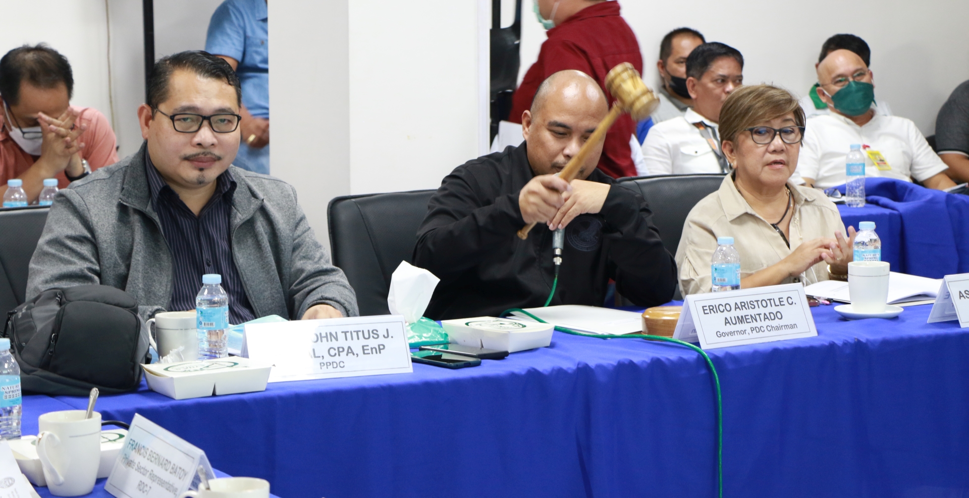
  • First PDC ExeCom Meeting Under Governor Aris AumentadoOctober 5, 2022
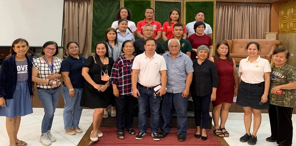
  • Revitalizing PGBh Partnership with the Civil Society OrganizationsOctober 4, 2022
  • Bohol Resettlement and Evacuation Program: Post-Odette Recovery and Rehabilitation Initiatives Towards Disaster ResiliencyOctober 4, 2022
More News

Province on the Web

  • Bohol Information and Communication Technology Office (BICTO) 0
  • Bohol Investment Promotion Center (BIPC) 0
  • Bohol Tourism Office (BTO) 0
  • Office of the Provincial Agriculturist (OPA) 0
  • PIMO Bohol 0
  • Provincial Government of Bohol (PGBh) 0
  • Sangguniang Panlalawigan of Bohol (SP) 0

Recent Comments

  1. Willy Bueno on Hazard Maps
  2. Christian Rey Lumantao on Hazard Maps
  3. Eric De Las Eras on Livestock
  4. jzmangyao@tesda.gov.ph on Livestock
  5. Willy Bueno on Bohol Districts Map
  6. Willy Bueno on Location Map

Office Address

2nd Floor, New Provincial Capitol Complex
Lino Chatto Drive, Cogon District
Tagbilaran City, Bohol 6300 Philippines

Telephone No.: +63 (38) 411-0138 loc. 42018

Email Address: ppdobohol[at]gmail[dot]com

© 2025 PPDO BOHOL • Built with GeneratePress